Another Local Photo Flight South of Melbourne, Florida · · PAGE 445.
September 15, 2018:
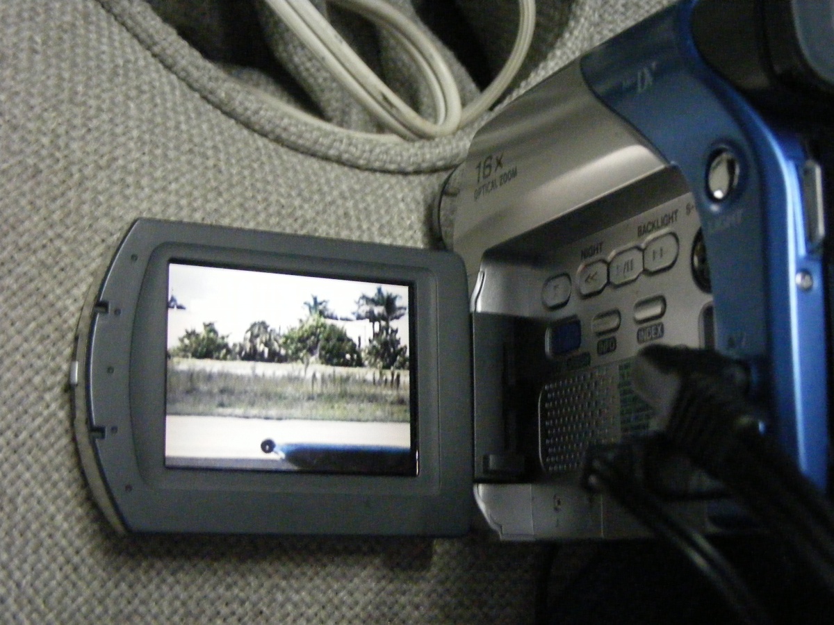
The Weather was good today, but hot in the afternoon. I spent part
of the morning working on my video camera to restore the bubble level on the
back end of the camera. The first thing to do was to level the video
display with
buildings on the west side of the runway.
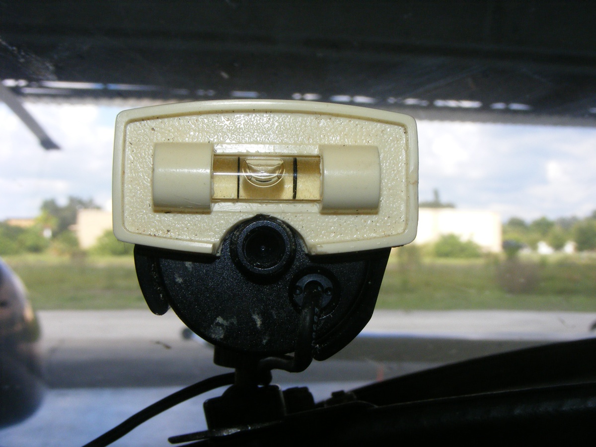
Here is the view in front of the camera with the bubble level attached
using double-sided foam tape, just like the initial installation in 2006.
With the camera and the digital camcorder ready for use, it is time to go
flying.
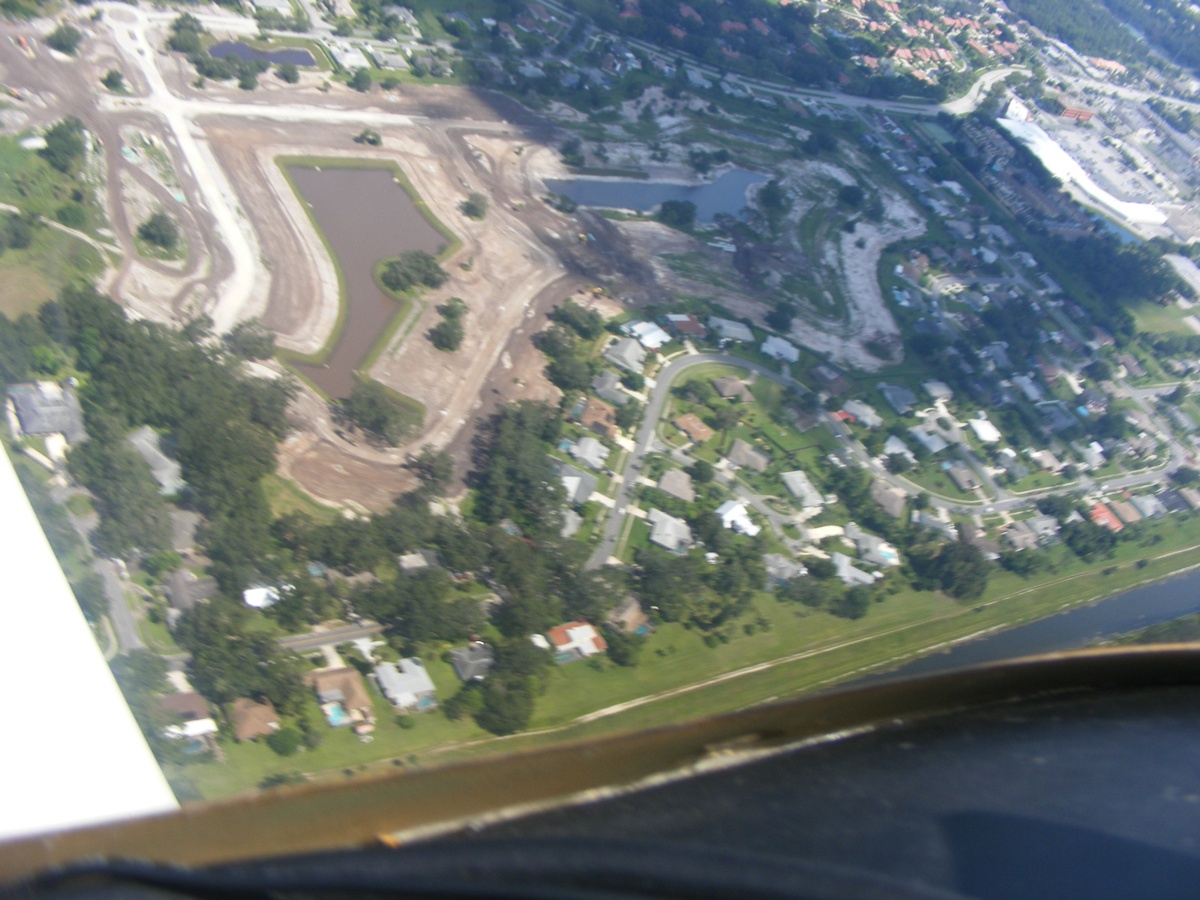
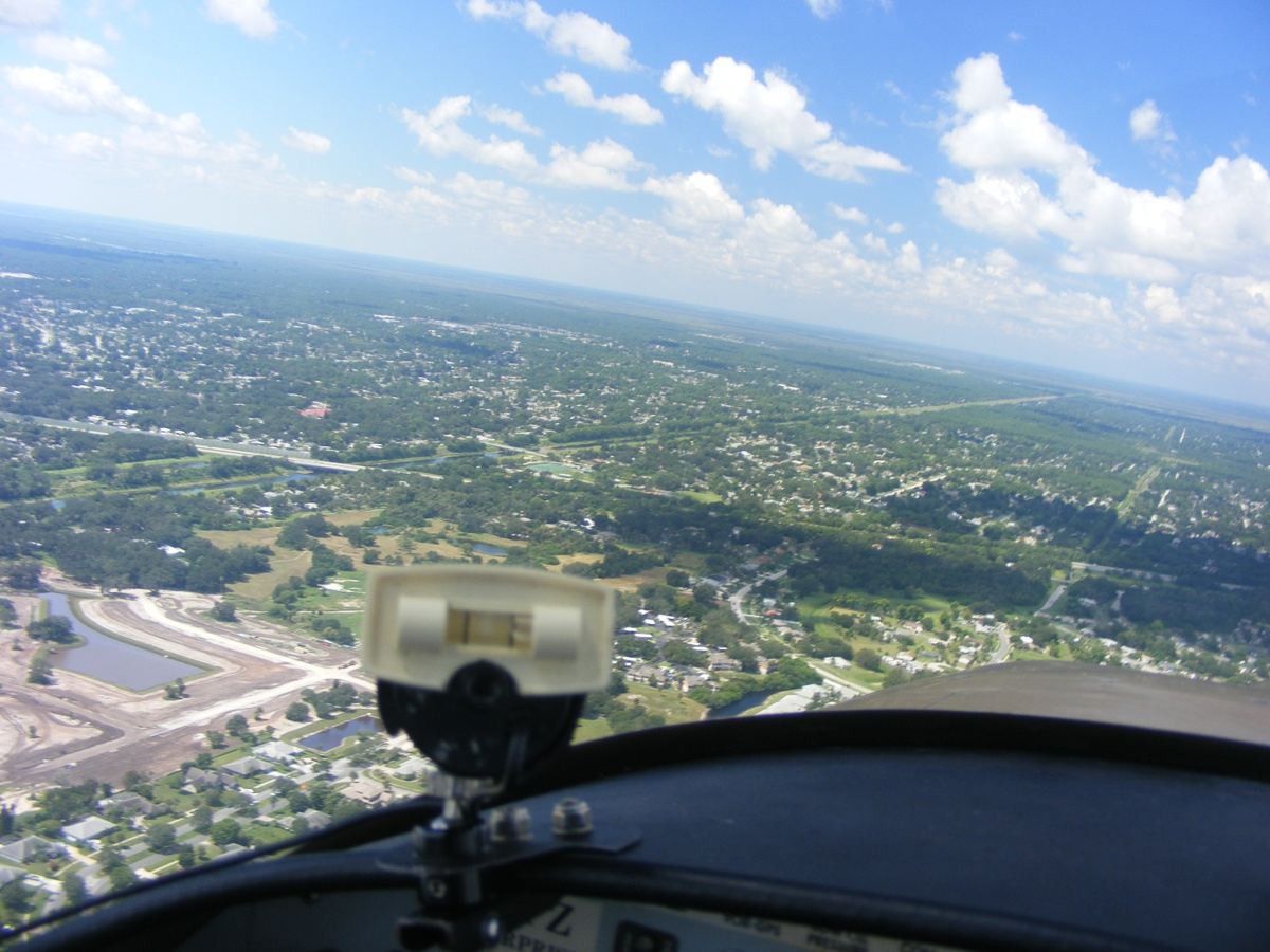
Flying East over the Melbourne Tillman Canal looking north gives a good
view of the project. Only ONE of the water retention ponds has grass sod
on the banks of the pond.
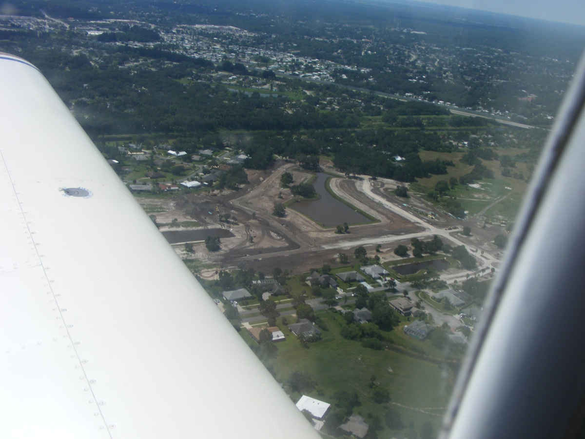
The view from northeast of the site, looking southwest.
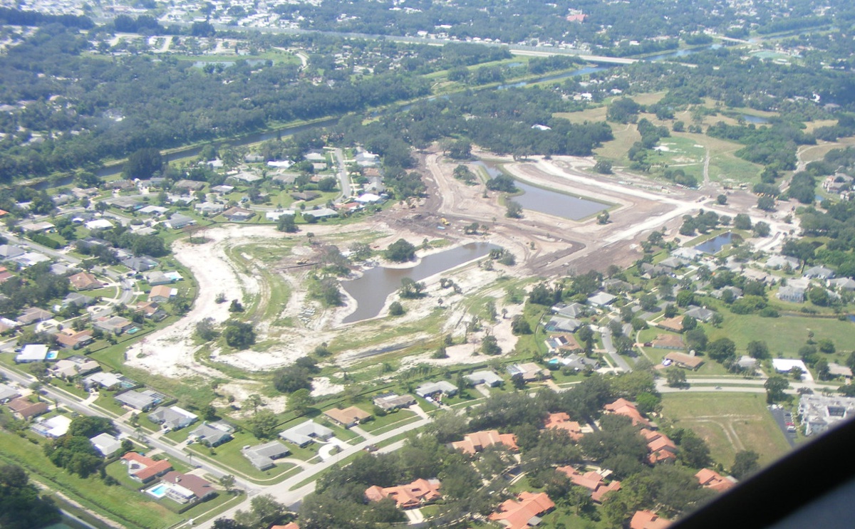
Interstate 95 and the Tillman Canal are the two major reference locations
in this area. This view is looking southwest.
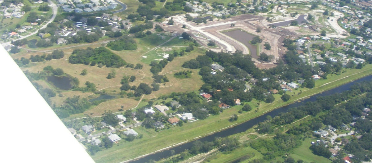
The view looking south while flying west on the north side of the job
site. I usually take several photos since I am not aiming, just pointing
when I take the shot.
My usual exit from this area it fly East before turning north over the top
of the Melbourne Airport above 2,500 feet MSL. The remainder of the ride
back to Rockledge descends west of the I-95 back to pattern altitude. The
landing was southbound, which was the direction of my takeoff at the beginning
of this flight.
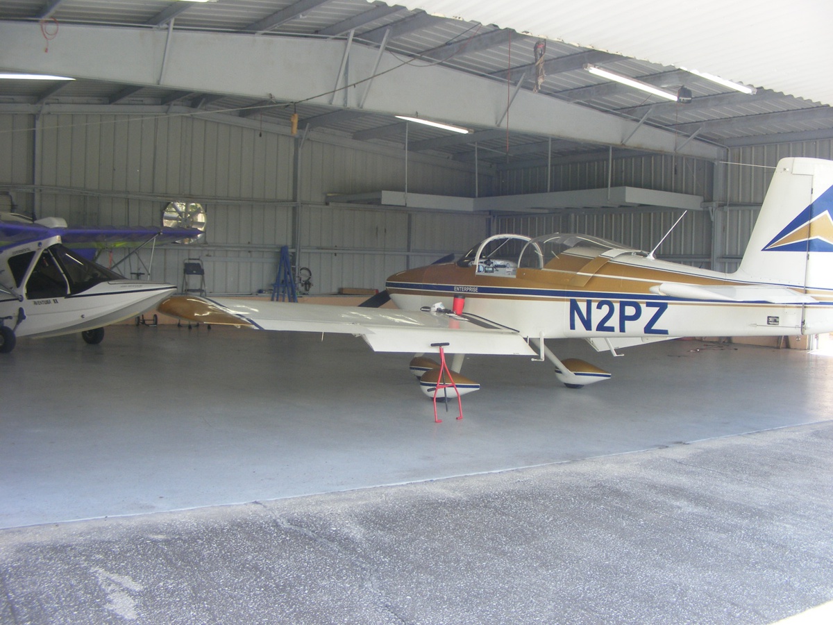
Every flight ends back here at the Air Land and Sea (ALAS) hangar.
With only one airplane in the northeast corner of the hangar, it allows me to taxi
into the hangar. On the flat floor, it is very easy to attach my tow bar
and spin the airplane around before I push it back into the southeast corner.
All that remains is to finish my usual Saturday chores and download the photos you see on this page. I also get to view the video I took today. The Hobbs meter adds 0.7 hours with one takeoff and one landing here at Rockledge.
September 23, 2018: Sunday again with today being the first full day of FALL. It is time to update the blog about living with Florida weather and how it affects my flying. I got up yesterday to the sound of a couple of airplanes flying over Palm Bay, the town where I live. I had my "usual hunter, gatherer" shopping duties yesterday. I was about 20 miles north of home as part of my search for an elusive grocery item only available at the Super Target next to I-95 in Viera. I had my usual Saturday lunch at that exit and then stopped by the hangar to recover my misplaced mini Swiss Army knife. I was on the floor of the airplane between the seats.
Today was a day that started with a good rain storm to wake me from a good night's sleep. I checked the weather radar to see how long the rain might be around. I did not hear any airplane engines this morning. No thoughts of flying for me today with the cloudy weather in this area.
October 13, 2018: This is the day of my first flight after Hurricane Michael passed us by down in Central Florida. The Florida Panhandle was hit at Panama City, Florida and other nearby coastal towns on the EAST side of the category FOUR hurricane causing massive damage. Tallahassee had 60 MPH winds taking down plenty of trees and causing power outages that are mostly restored as I write this page.
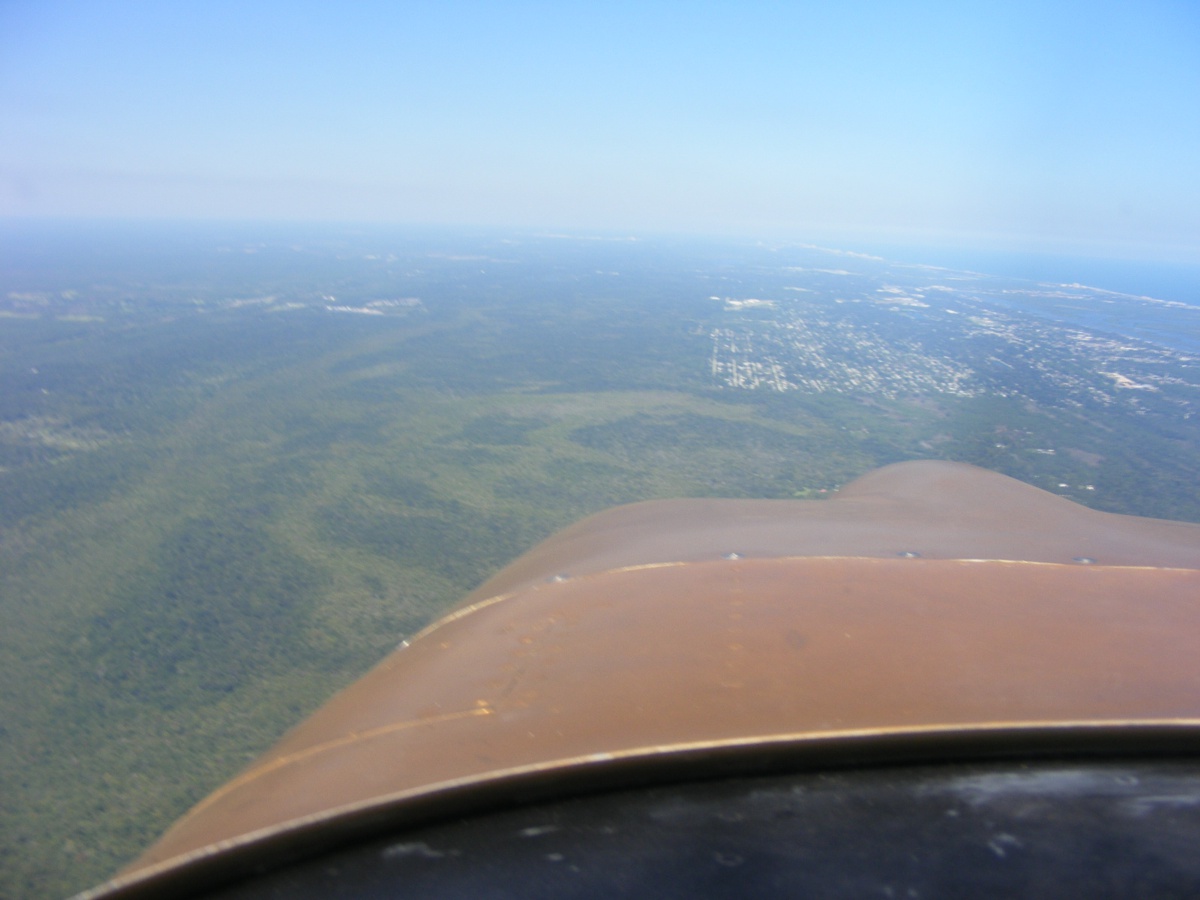
My flight today was up to Massey Air Park (X50) for a touch and go
landing. This is the only in-flight photo taken today from about five miles
south of Massey looking north as I approached. The headwinds were about 20
MPH at 2,500 MSL. The turbulent layer from the ground was at about 3,000
MSL. I dropped down to 2,500 for most of the flight with some areas where
3,000 MSL was better.
There were a couple of airplanes on the ground and final approach as I
entered the pattern for runway 36. I made a short turn downwind to enter
the pattern for the landing.
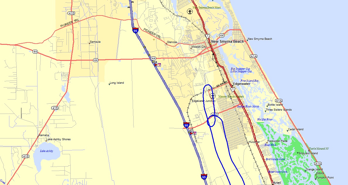
I made another quick touch and go landing at Merritt Island airport where
the wind on the field aligned with runway 11. The orange wind sock did not
have a white segmented circle for high visibility. The wind at 2,000 feet
MSL was about 15 MPH and from a different heading compared to on the
ground. This ground track shows just how close Rockledge is to the Merritt
Island airport. My takeoff and landing at Rockledge used runway 36.
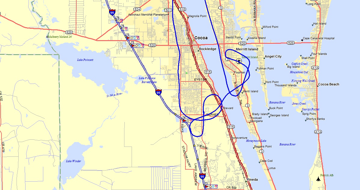
Here is the entire flight path.
The Hobbs meter added 1.1 hours today with three landings going into the log book.
October 21, 2018: This Sunday finds me visiting my sister after driving from Melbourne, Florida to her home in Grayson, Georgia. I have a trade show that runs Tuesday, Wednesday, and Thursday of this week at the Georgia World Congress Center in downtown Atlanta. I will return home at the end of this week.
October 27, 2018: I returned home yesterday around 6:30 PM. The rental car was cleaned out of all my major items before it got dark. I finished clearing out the other items today (Saturday). I went to vote for the general election as part of the EARLY VOTING here in Brevard County this afternoon. I was talking to a customer at the trade show about the fate of Amelia Earhart as reported in a 2017 History Channel program from evidence found in the US Archives.
Here is the link to that program on YOU TUBE: https://www.youtube.com/watch?v=sCS4s4Io9lc
| CLICK HERE for PAGE 446 | Return to MAIN MENU |