Final Assembly and Flight Testing - Page 140.
June 20, 2005: I put the wheel pants back on the airplane and applied a couple of pieces of UHMW tape to the inside of the aft canopy skirts where they were rubbing the aft fuselage skin above the baggage area. The rains came after lunch and I did not fly or even fill up the fuel tanks. John Wright came by the airport and offered me a chance to see his grass strip and his 1946 Taylorcraft.
June 21, 2005: The weather was better today
and I made a 3.8-hour flight up around the north side of Knoxville and across the northern
counties of Tennessee. I stopped at the Hawkins
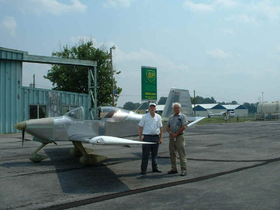
County Airport (KRVN) near Rogersville, TN. I stopped for a while and met
A&P Jim Summers and some of the other guys that hang around the airport. They
also provided me some information about other airports in the area and the likely location
of another RV builder in an aviation community near Greeneville, TN.
During the trip today, I had a chance to work with the controllers at Tri-Cities (Class D), Knoxville, and Chattanooga (both Class C). I flew to the Johnson County Airport near Mountain City, which is the Eastern-most public-use airport in Tennessee. When I entered the pattern there, I noticed several maintenance vehicles on the runway. I received no reply when I first called Unicom, but as I flew overhead and realized I would not be landing, the FBO called up and said they would move the vehicles off the runway if I needed to land. I thanked him for the offer and told him I just came by to see his airport and did not need to stop today. I must admit that the trip back there was interesting. I passed by some mountains that were significant and across some beautiful lakes up that way. Sorry, I did not take any photos in that area as I was busy flying in bumpy air.
When I returned to Collegedale, there was a rain shower on the north side of the airport. I heard a flight instructor I know making a quick landing with a student pilot from the south end of the field, but it was socked in by the time I got close. I diverted to Dallas Bay for a short stop, then called Chris at ASI/Collegedale to confirm that the rain shower had departed the area before flying the short trip back to Collegedale.
At the end of the day, the GPS showed a track of 522 statute miles in my flight path. The fuel used was 21.8 gallons of 100LL for an average fuel economy of 23.94 MPG. That's not too bad for a moving average speed of 137 MPH. My true airspeeds cruising in level flight were in the 160/170 MPH range. I slowed down at all three airports along my path where I flew overhead or made landings. The takeoffs and landings were at Collegedale, Rogersville, and Dallas Bay Sky Park. I also flew just south of the Tri-Cities Airport, and over the airports at Elizabethtown, Johnson City, and Sevierville (Gatlinburg/Pigeon Forge) Tennessee.
June 22, 2005:
Wednesday -- a maintenance day with no flying. Rich Nadig was back on the field and
I discussed my recent flights and discoveries about fuel usage and cruising speeds.
We should be able to calibrate my fuel gauge on Friday of this week. Larry Champion
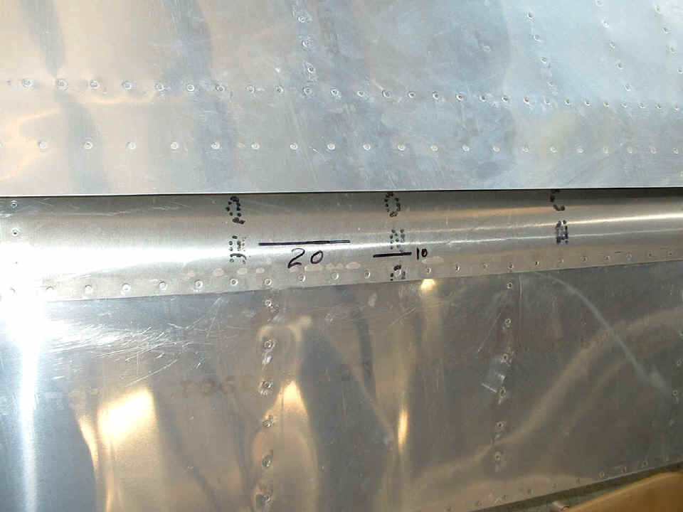
came by the airport this afternoon and I asked him to help me with putting some flap angle
markings on my LEFT FLAP. I took this photo standing over the flap and the wing rear
spar. We measured the flap extended to the 10-degrees down position and put in a
line that was visible when I am sitting in my seat. Then I extended the flaps to 20
degrees and Larry made another line. The full down position is approximately 30
degrees of flap extension.
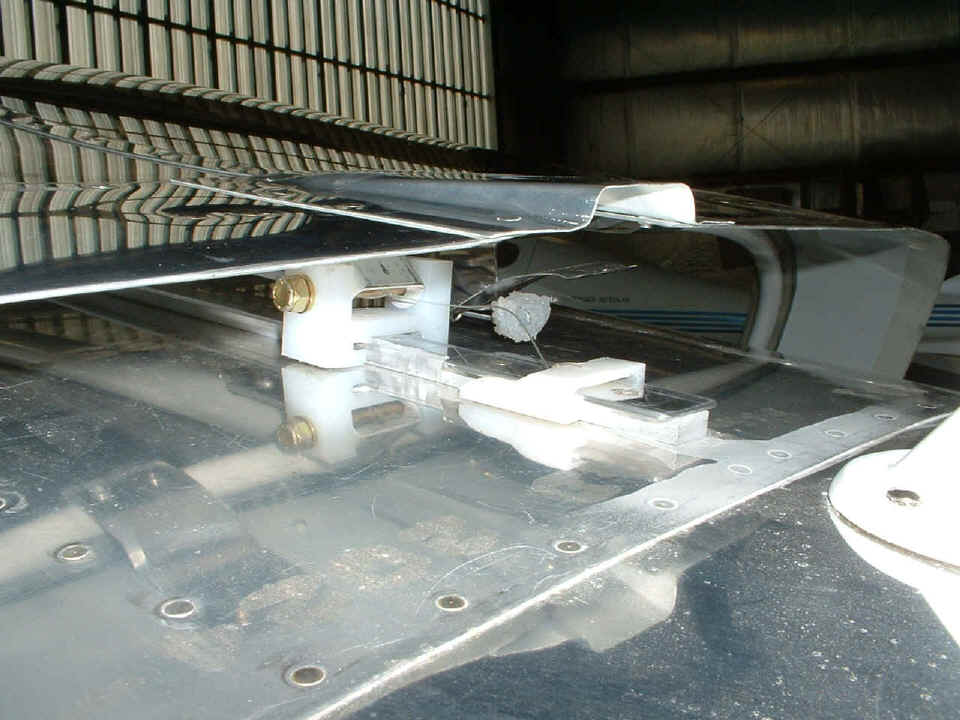
I put back the slider that plugs the aft opening of the "Dog House"
at the rear of the canopy. That is nylon fishing line serving as a lanyard to
position the slider in the correct position when the canopy is closed. I also
realized that I needed some clear RTV at the front of the Dog House where the flat center
aluminum strip goes under it. That may have been the source of the few drops of
water I found on my briefcase when I was dodging rain showers last week.
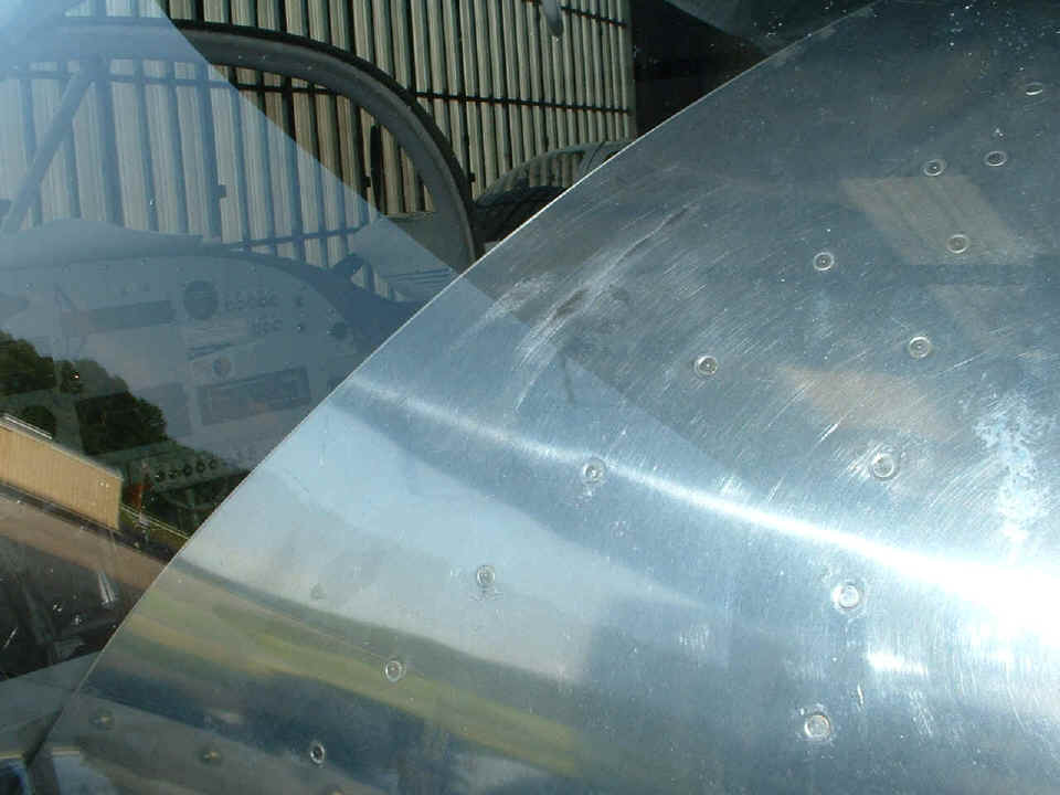
This photo shows the scuff marks on the left side of the rear top skin where
the aft canopy skirt was rubbing. I put the UHMW plastic tape on the inside of the
canopy skirts as I mentioned at the top of this page. I may have to put some of that
tape on the skin you see here through the canopy, AFTER the paint job goes on.
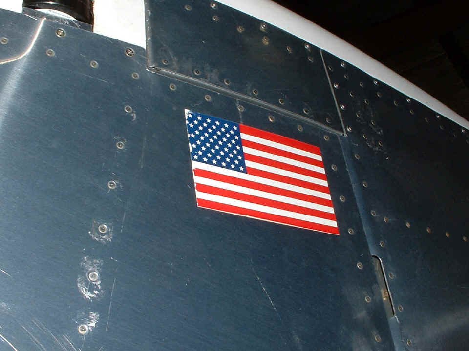
Here is a testament to the 200 MPH true air speeds I have had in some recent
descents from altitude. My flag is literally being "blown away" bit-by-bit
during the downhill runs from 8,000 and 10,000 feet.
I also got out my 8-32 tap and cleaned up some stiff platenuts in the cabin that had damaged some screws when I was putting in the seat pans and the covers on the flap actuator. All the screws in the ribs and spars are now properly secured. I also brought my computer to the airport and installed new software in the Dynon D10-A. I started to do the calibration of the external magnetic sensor and realized I needed some data on magnetic inclination before I could complete that task. I guess I will have to take my computer to the airport again to complete the job. When I finished all that I could do, I just did not feel like going flying today, even though the weather was good (but hazy). There is always tomorrow.
I guess the 2.4 hours worked in the hangar is qualified as maintenance, and not new construction on the airplane. With that as the case, I will not update the build time on the home page until I do something NEW, rather than reworking what is already done. I still have some covers to put in place and of course the upholstery at the appropriate time after painting. As I was posting this page, an email came from FEDEX with a tracking number for my seats and interior shipped today from Flightline Interiors! One more step closer to completion! Now I have to see what I can arrange about getting the airplane into the paint shop!
June 23, 2005: I flew a
mission to run the MAG CAL routines on the new software in the Dynon unit over middle
Tennessee. I missed one step and will have to try it one more time in the next
flight. The cloud layers are lower just west of the Cumberland Plateau. After
flying my four courses in the MAG CAL setup, I landed at Shelbyville for a short break.
At this time of the afternoon, you can get one of several shady parking places in
front of the terminal. I had several folks come up to ask about the airplane and I
gave them each a card with the web address and vital statistics on it. The
"golden" tiger-striped airport CAT greeted me as I went into the terminal
building. The shade trees make the park bench in front of the terminal building a
nice place to sit and watch the action on the flight line.
This second photo at Shelbyville Airport shows the western boundary of my test
area. At the far left edge of the photo is a street way back there beyond that
pickup truck. That "street" is really US highway 231, which runs along the
western boundary of the airport.
After the break, it was back up in the cool air and some flying to the Manchester area before heading home to Collegedale. The total flight time today was 2.5 hours on 14.0 gallons of fuel covering a GPS ground track of 323 miles at an average of 23 MPG. I love this bird! Coming down hill past the Chattanooga Class C was a blast a 200 MPH TRUE airspeed through 7,000 feet. The INDICATED airspeed was still in the green arc around 170 MPH at the highest descent speed.
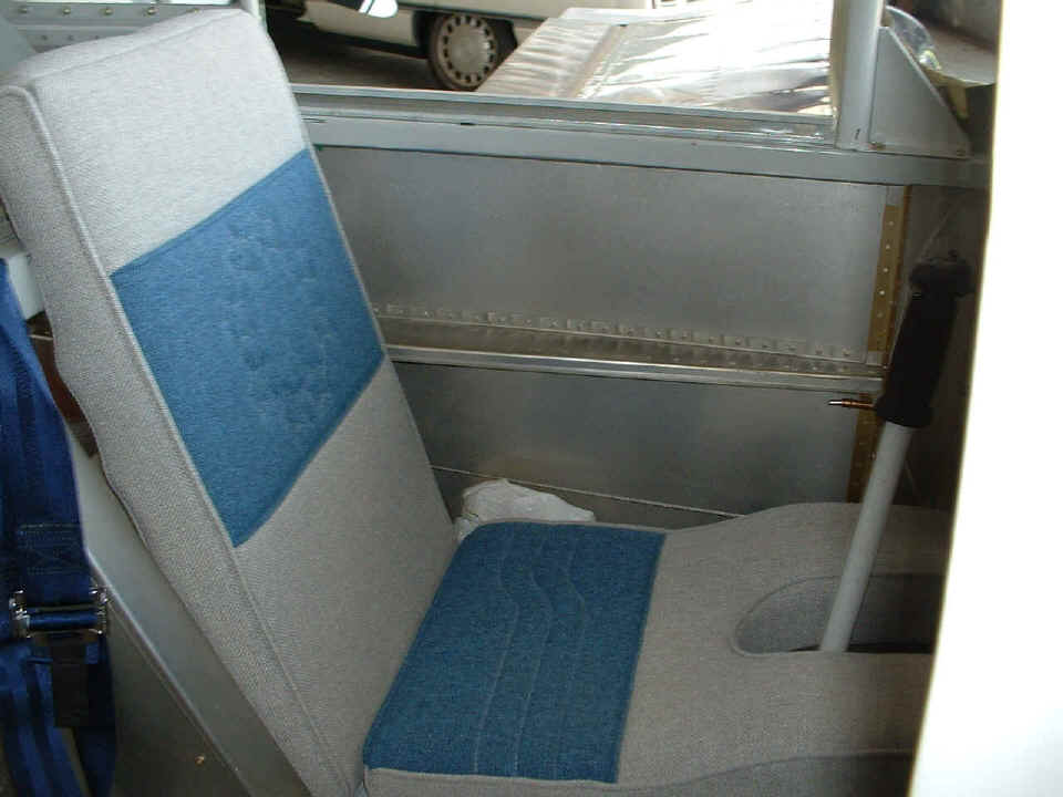
June 24, 2005: FedEx
delivered the upholstery package just before 2 PM. After looking it over and taking
inventory, I headed to the airport with just the seat cushion and back cushion for the
pilot seat. I got it installed and then took a short flight up the Tennessee River
and back with a "touch-and-go" landing at Dayton, Tennessee airport. I
executed a side-slip to a landing upon my return to Collegedale. Looking at the
picture below, it appears the camera focused on the armrest, not the cushions. The
seat back has a circle of stars in the blue fabric. I still have to decide if I want
the "wedge" cushion under the main seat cushion or not. Headroom is the
issue with that. I will keep you posted after I have flown with the wedge in
place. Today's flight was without it.
One more thing to note, there is no more oil appearing on the bottom of the fuselage. The dip stick is holding steady at just under SIX quarts of oil in the engine for the past few flights.
June 25, 2005: Just a short flight (0.7 hours on the Hobbs) to a nearby turf strip where gliders hang out. The weather today was dreary during the morning and early afternoon. The visibility was about SEVEN miles judging from what the GPS was telling me when I spotted landmarks ahead of me on the ground. I had one go-around, then a good turf landing before heading back to Collegedale Airport.
June 26, 2005: I had to wait for some passing rain showers at Collegedale to get going today around 4 PM. After that, I climbed VFR though the scattered and broken cloud layers and flew up the Tennessee Valley, then over to an area that had better ground visibility over the Cumberland Plateau. I spent most of my time at 12,500 feet talking with Atlanta Center via the Hinch Mountain VOR ARTCC outlet. I made a few trips back and forth between the Knoville area and Sparta Tennessee. I even flew the four courses needed to do another magnetic calibration of the Dynon remote magnetic sensor. I am still not happy with the results. I suppose I will have to sweat it out on the compass rose at Collegedale pushing the airplane around or whatever. I will have to call Dynon and speak with the design engineers to be sure I account for all the anomalies.
I also went up to the airports near Oneida and Jamestown, Tennessee. After my first landing, I taxied up to the FBO at Scott County Airport near Oneida. The office was locked up, so I took off for Campbell County Airport near Jacksboro and LaFollette, Tennessee. I thought about retired Senator Howard Baker as I flew across his home town of Huntsville, TN. I first met Howard in the 1970's when he and his law partners built a cable television system in their town. I was the young Jerrold field engineer who wired up the headend and checked out the signals at Howard's house. He was the first subscriber connected to the system as it was being tested before the start of service to the public.
I encountered some light rain a few miles from the Campbell County airport and turned around for better weather to the west, which took me to the airport at Jamestown. I also found the FBO locked there, but one of the three local pilots there had a key and let me in for some relief down the hall. After that, I had some good conversations about the airplane since they could tell it was new. I passed out my airplane web cards and we discussed the specs on the RV-9A and my engine/prop combination. They also told me some of the details of other nearby airports to visit during the rest of my test period of 40 hours. Today's flight brought the Hobbs meter to 20.0 hours when I pulled up at the hangar back at Collegedale. The GPS ground track showed a total of 457.5 miles today. I left Collegedale with full tanks and I calculate that I have burned about half of that, or around 18 gallons. I will find out tomorrow when I hope to work with Rich Nadig to drain the tanks and fill them three gallons at a time to calibrate the fuel gauge. I also have to get the oil changed and replace the oil filter. I want to examine the contents of the old filter after we cut it open to look for metal fragments from the engine break-in during these past 20 hours.
I want to apologize for not taking any pictures today. My mind was on other things even though the camera was right beside me. I am not too happy with the autopilot and how it worked today with the GPS. It kept letting go of the heading and the course line. I tried it both ways. Sometimes it would lock on to the "heading" about 10 degrees to the right of the heading I was actually flying when I would "calibrate" the smart coupler to the GPS NMEA heading data coming from the Garmin 296.
June 27, 2005: Today was a maintenance day during the day, with a 1.7-hour flight in the late afternoon. It started out with me taking the cowl off to access the fuel lines. The reason for this was the calibration of the fuel gauges. Here is the logic:
1. Pump THREE gallons of 100 low-lead aviation fuel into a
five-gallon fuel container.
2. Mark the level of the three gallons of the fuel container.
3. Pour that fuel into a larger 15-gallon fuel container for holding.
4. Pump all the usable fuel out of the aircraft fuel tanks. With
yesterday's flight of 3.2 hours, the tanks should be just under half full.
5. Put three gallons in the five-gallon container.
6. Start the calibration sub-routines on the fuel gauge at the
"EMPTY" fuel level (CAL 1 routine).
7. Pour in three gallons of fuel and run the CAL 2 routine.
8. Pour in another three gallons and run the CAL 3 routine for SIX gallons of
fuel.
9. Repeat for NINE gallons at CAL 4.
10. Repeat for 12 gallons at CAL 5.
11. Repeat for 15 gallons at CAL 6.
12. Repeat for 18 gallons at CAL 7 for a FULL tank of 18 gallons.
The only problem with all this, the three-gallon mark on the five-gallon container was MORE than three gallons. The 18-gallon fuel tank filled to the top before we put in the "15 gallons". No, this was not due to unusable fuel of three gallons since I know that only about 4-ounces remain in the tank when the fuel pump stops pumping it out. When we filled the five-gallon container, there was an error in the readout. The big deal of the day was a bust and I wasted some really nice flying weather. Rich Nadig showed up late in the afternoon when we discovered the problem. He went up to the fuel pump and put in 12 gallons in his calibrated 15-gallon fuel containers and got 12 gallons. He took the second container down to the other fuel pump and found the same accuracy there. The only thing that makes any sense is the FBO main fuel pump was not properly primed when we put in the first "three gallons" early before lunch. This apparently created the erroneous reading since the fuel was being pumped into the five-gallon container VERY SLOWLY.
Wendell Folks had come to help me with the calibration routines and held the five-gallon container under my fuel line when I drained the aircraft fuel tanks. He also poured in each "three gallon" measure as I ran the fuel gauge CAL routines. By the time we realized the whole process was a bust, it was time to load up all my stuff on his trailer to take down to his work shop. The drill press/bench grinder table, the wing storage cart, and the work table were put on his trailer. After that was done, the saw horses and the air compressor went on to fill up some of the empty space and he headed for home near Chickamauga. I put the cowl back on and taxied up to the FBO fuel pumps to fill the LEFT tank after we had filled it, then transferred all the fuel to the RIGHT tank, "three gallons" at a time during the fiasco of the day. At least I would get to go flying for a few hours.
OK, I am getting ready to head for the pumps and some rain comes, but the sun is still shining. I look out the hangar and see a real thunder storm about 20 miles to the SE heading our way. I hurry up to the pumps thinking I will at least get to fill the "empty" left tank. I noticed that it only needed 15 gallons. I ran in the FBO and checked the weather radar on the computer and decided there was good weather to the north. With full tanks, I knew I could go up there to fly, then come back after the storm passed through the Chattanooga/Collegedale area. And that is what I did. I climbed up to 12,500 feet by the time I got over the Cumberland Plateau and did a couple of trips East and West between Crossville and the area near Rockwood and Harriman, Tennessee. I saw some power windmills for the first time today up in that area. I was talking with Atlanta Center and asked him to advise me when the weather in the Chattanooga area improved to allow me a VFR decent and return to Collegedale Airport. Atlanta handed me off to Chattanooga Approach for my descent. I was coming down through 10,000 feet at 220 MPH true airspeed and the indicated speed was just touching the yellow arc. I pulled the throttle back further and trimmed the nose up a bit and steered around some minor clouds to remain VFR. I flew around the northeast side of the Class C airspace to get to the Collegedale airport that was now visible from five miles away. By the time I got home and put the airplane away, the Hobbs showed 21.7 hours on it.
Now, where are the windmill pictures? You guessed it, I left the camera in the CAR in the hangar. I was so upset with the wasted day on the fuel calibration issue, I took off without the camera. And of course, when I am involved in a "procedure" I tend to neglect my photo duties. But all is not lost. We will have to do all that pumping again some day soon, and I will get some pictures during that "successful session". As for the windmills, I was just loading some laundry downstairs and I decided I would visit that area again at a lower altitude and get some good pictures up there and the various power plants along the Tennessee River. No, I am not even thinking about going NEAR Oak Ridge, Tennessee.
| CLICK HERE for MORE Flight Testing on PAGE 141. | RETURN to MAIN MENU. |