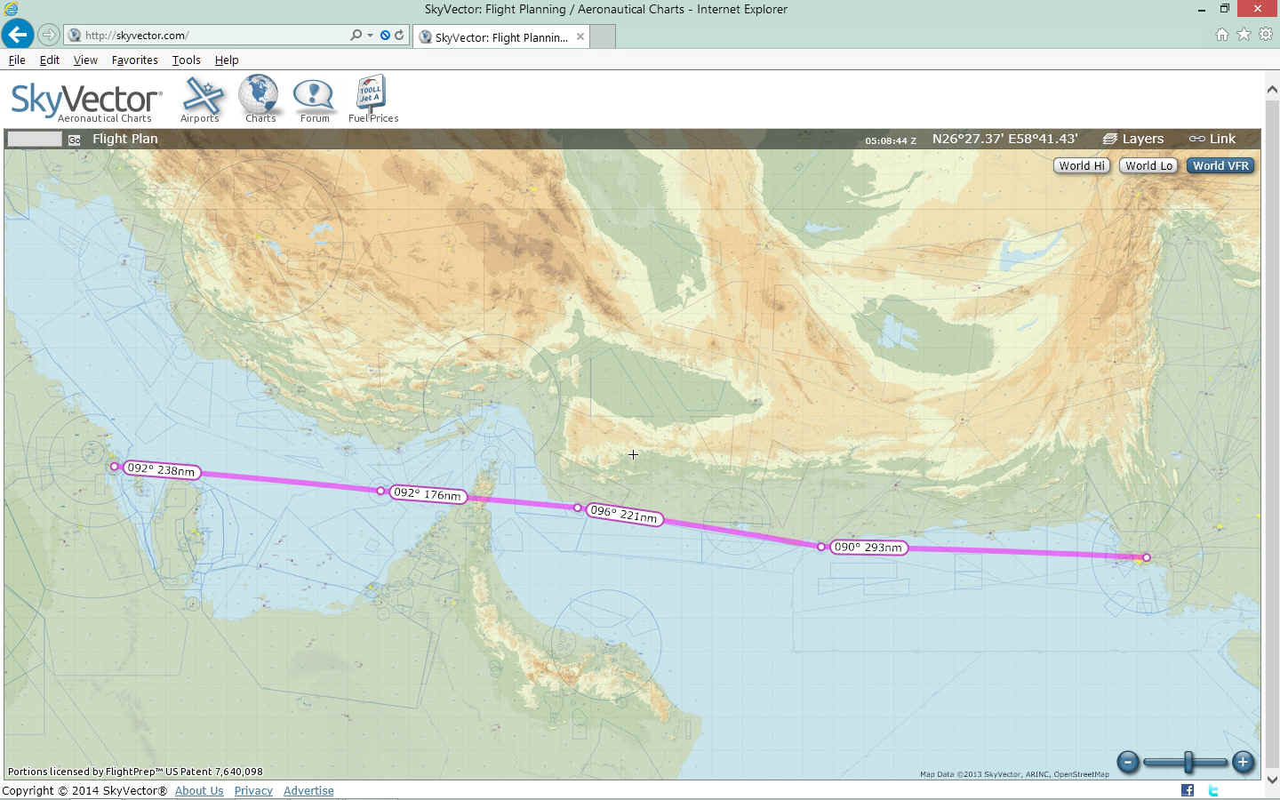
Dhahran, Saudi Arabia to Karachi, Pakistan · · PAGE 8.
April 4, 1964: The flight to Karachi,
Pakistan was clear all the way except for crossing the Sarjah Peninsula near the Strait of
Hormuz. There were some 8,000-foot mountain peaks there and low-hanging clouds with
drizzle. She was cruising at 7,500 feet MSL and had to descend some to stay under
the clouds. She flew through a mountain pass and out the other side heading EAST to the
Gulf of Oman into bright sunshine. The mountains trap the rain clouds (just like in
Hawaii) on the East side against the prevailing wind blowing West. That area was the
only green vegetation she had seen since she left Algeria, other than a small oasis or the
Nile River delta.
The RED line again shows the course to the next destination beyond this
mountain range. Jerrie did not say how much she descended to get under the clouds.
This area seems to match her description of finding a low pass and winding her way
through it under the clouds.
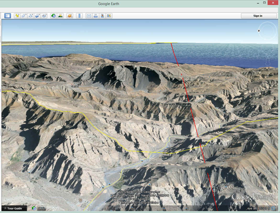
UPDATE July 1, 2015: The Google Earth tour GPS file is
now loaded on the GE Tour page that has this flight segment from Dhahran to Karachi ready
to fly. I cannot recreate the cloud cover, light rain or mist, but I did set the
tour altitude and route below the peaks of this area and flew a path that could be how she
went through this area seen below. For best visual impact, I selected 4,000 feet MSL
for her flight altitude through this area. Be sure the SUN option is selected under
VIEW before beginning this tour flight. The mountain shadows in this area add to the
rugged beauty.
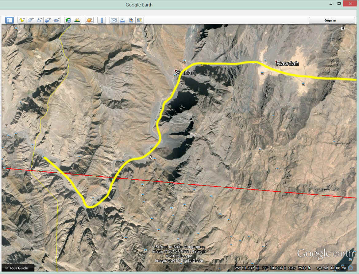
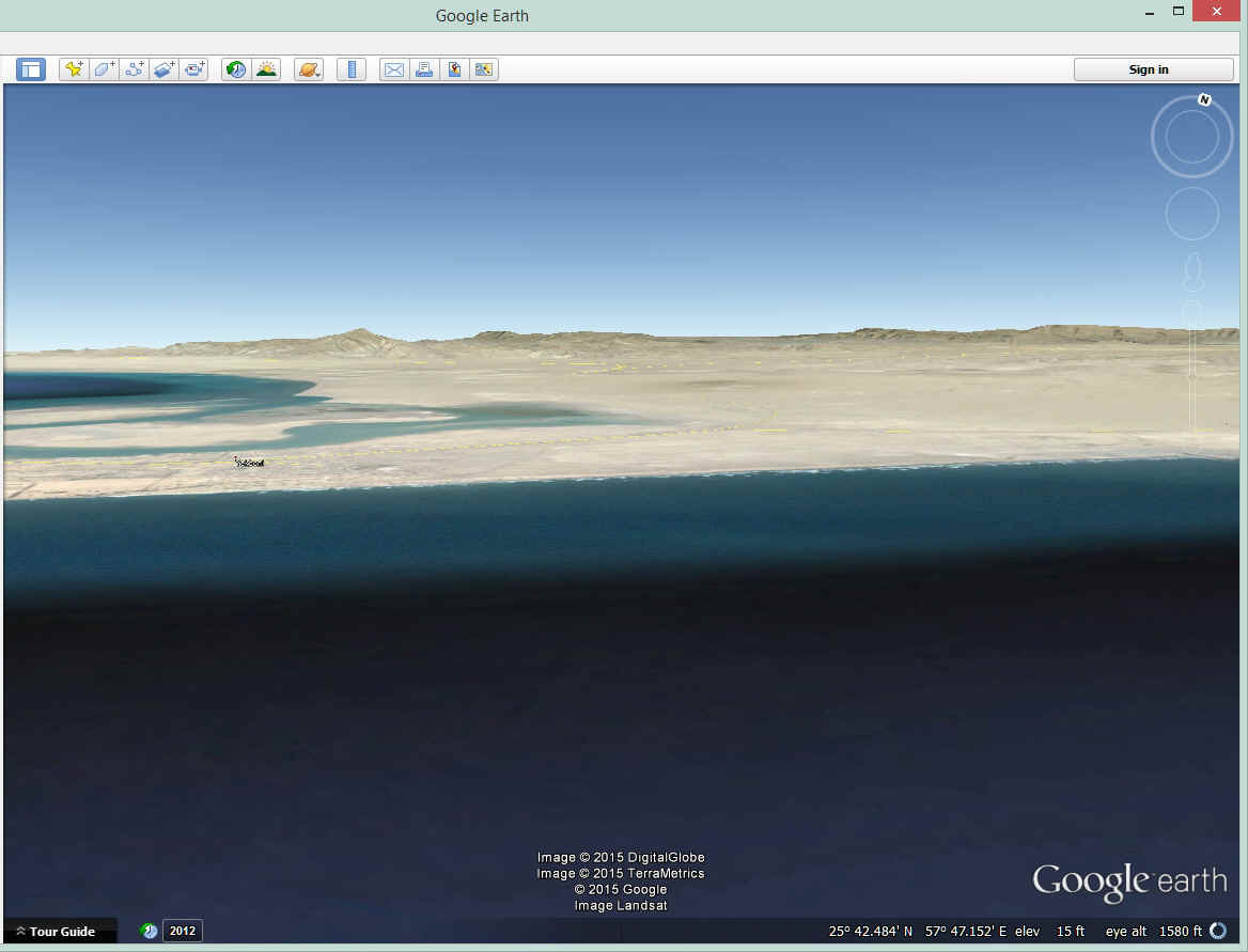
This second image looks down at the probable route between rocky peaks on
either side of her airplane. She could not see the tops of the mountains but can see
a clear path below and on both sides of her airplane. There is also a road following
about half of this route.
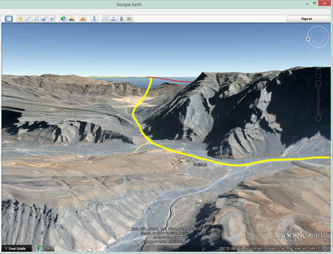
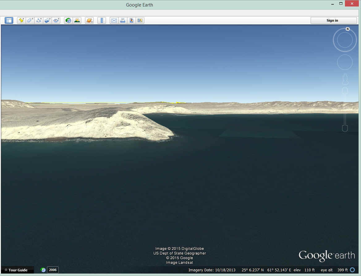
Back down at her probable altitude under the clouds, this is the path that
continues East toward the Gulf of Oman and getting back on her course out at sea.
The clouds dissipated on the East side of the mountains and she resumed her cruising
altitude of 7,500 feet MSL.
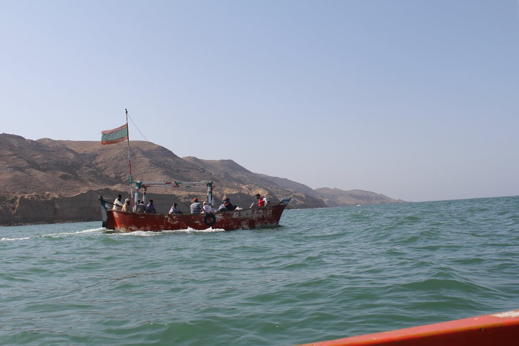
Out over the Gulf of Oman, she finally sees the south coast of Iran on the left
side of 38 Charlie.
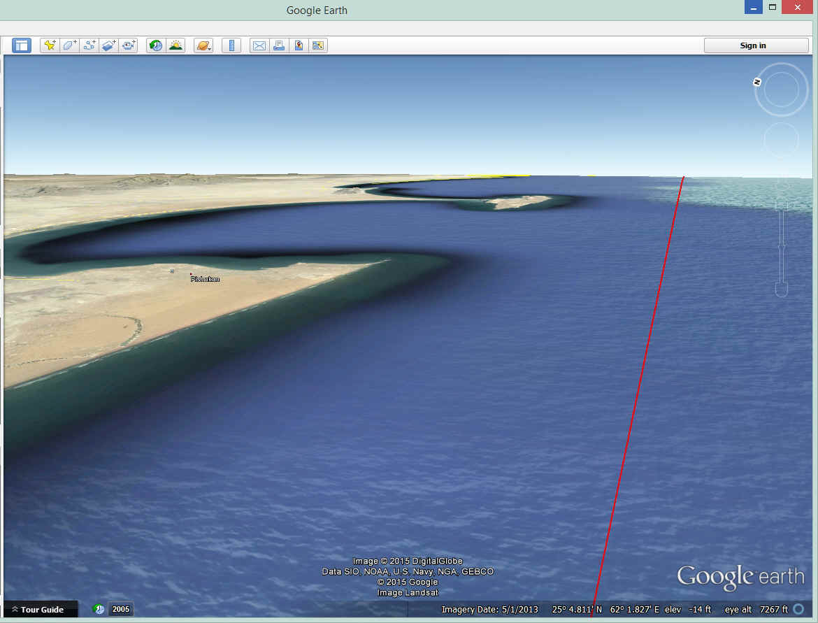
She commented about the cliffs along the Iranian shores as she followed Airway
A-1 for about 250 miles. At this point she thought about the sheer beauty of the
view of the clear indigo sky above, a coral reef below the water, and the shimmering
golden palisades. That is not an exact quote, but you get the idea of how she sees the
world around her, when others would just see desolation where the sea meets the desert
landscape. She mentions how low and slow sightseeing flights for tourists in this
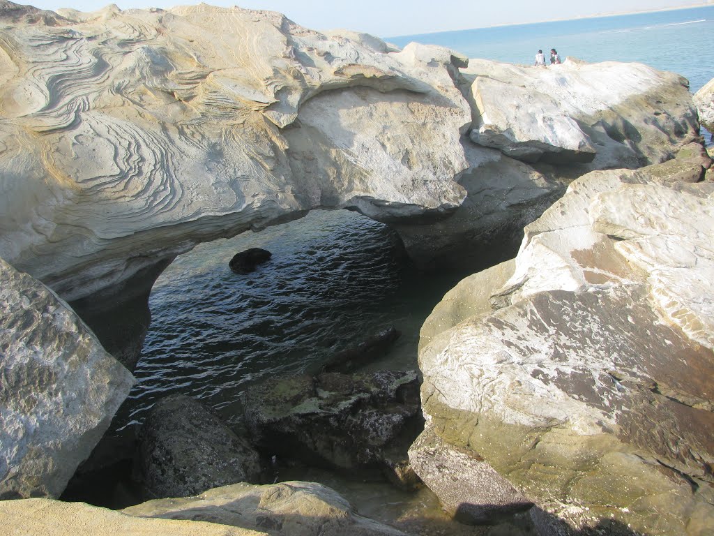
area would be nice. The image below was created manually by setting the "eye
altitude" at about 400 feet above sea level to show the cliffs. Jerrie flew
along this path at about 7,500 feet above sea level as seen in the Google Earth tour
flight of this route to Karachi, Pakistan.
She received a radio call from a Pakistani Airliner about this time. The
pilot indicated Karachi wanted to know her occupation. What kind of question was
that? She asked him to repeat the request. When she said housewife, there was
long pause before he thanked her. She thought the man sounded puzzled about her
reply. At this point she started to think about how the people she met since Bone,
Algeria have reacted to the fact that a woman is flying solo around the world. She
also thought about how flying regulations were different in this region. A TWA man
had helped her file a flight plan before she left Dhahran this morning. He told her
how some recent changes by Pakistan were not correct on the Jeppesen charts. Some
things had not been implemented due to a shortage of funding. He advised her of the
correct requirements for the flight to Karachi.
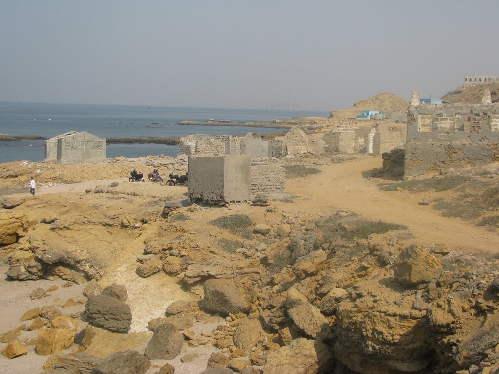
Airway A-1 kept her out over the water until reaching Pakistan near the mouth
of the Indus River seen here.
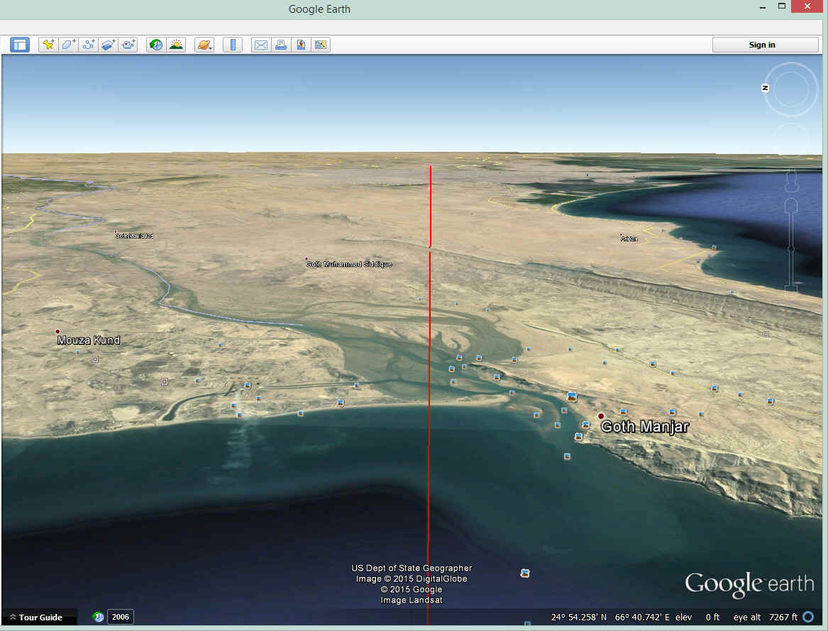
The mouth of the river has some beautiful scenery.
Even in Pakistan, a house near the shore with a good view is just a popular.
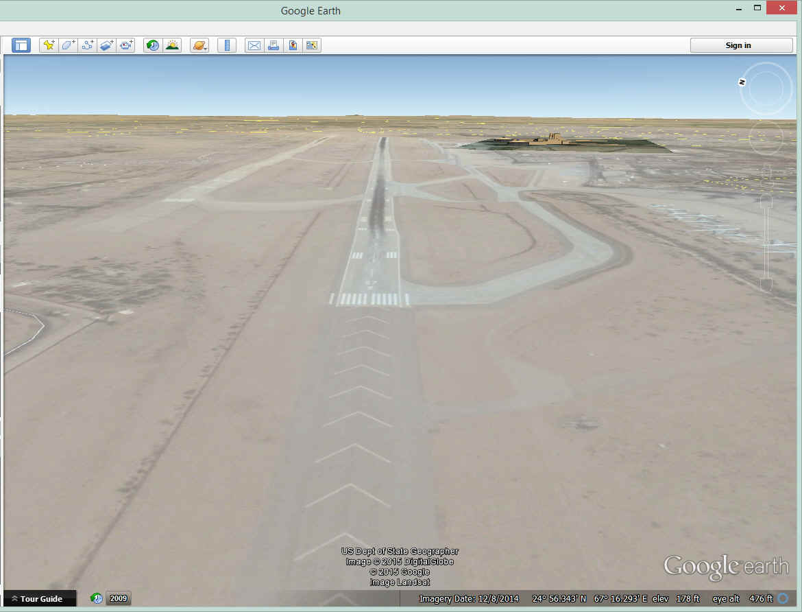
As I was "flying into Karachi" with Google Earth, I noticed a
military airport, but Jerrie landed at the International Airport as planned.
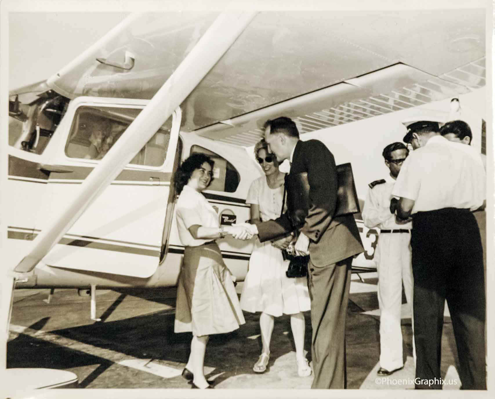
Here are Jerrie's thoughts about here arrival at the Karachi airport. "The crowd of people that met me at Karachi Airport wasn't as large as at Dhahran, but there were quite a few people. There were Aero Club officials who had come to sign my NAA forms, the press and another officials, and people whom I couldn't figure out. They all spoke English, but it's funny how the same things can mean different things to different people."
Jerrie was met at the Karachi airport by the John and Adelaide Tinker from the
US Embassy. They are also members of the Aero Club in Pakistan. She was their
guest for the night, and always the lady pilot on an adventure to have a good time.
She commented about the different cultures in this part of the world with a woman's
viewpoint, from the veils and shapeless black cloaks of Saudi Arabia to the bright silks
and pantaloons in Pakistan. At the time of her visit in 1964, Karachi had a
population of about 2 million people and was the capitol of Pakistan. A new capitol
was under construction about 700 miles north at Islamabad or "City of Islam".
Jerrie talks about the evening meal with Iranian caviar and steak with the Tinkers at their apartment in Karachi. She commented on the view from the guest room and how she could see the Arabian Sea out one window and the Gulf of Oman out the other window. They went up on the roof where Adelaide had a telescope for viewing the stars in the clear desert air. She learned how difficult it is for members of the Aero Club to take a short domestic flight due to the bureaucracy and regulations. They had to do the same things she did on an international flight. Jerrie thought of the problems and delays she had in Cairo just to file a flight plan, get fuel, and clear customs before her departure from Egypt. She decided to take the easy route across India with a stop at New Delhi to clear customs. Then a day flight the next day to Calcutta where she can arrive in daylight and have time to file her flight plan for the following day to Bangkok, Thailand.
She had time to write some letters and got the mail from home that had been sent to the embassy. She also wrote a long story for the Columbus Dispatch newspaper as they were one of her sponsors for the trip. She said this took a long time as she kept going to the window to watch the sunset and then the stars coming out after dark. She learned about the other woman circling the globe, Joan Merriam Smith from Oakland, California. Joan is about two days behind Jerrie according the latest news reaching the embassy. Read this book to learn all the details about "the race" to get into the record books via the two different routes taken by both American women pilots flying around the world.
| CLICK HERE for PAGE 9 | CLICK for Jerrie Mock MENU | Return to N2PRISE MAIN MENU |