Wendell's Aeronca Champ Heading to Amarillo - - Page 2.
May 7, 2013: Terry took this out of focus
telephoto picture looking ahead at 9:43 AM at a solid layer of clouds below.
The camera focused on the propeller arc as you can see by the reflection on the left side
of the photo. Regardless of the focus, the solid layer of clouds below is something
to be considered here.
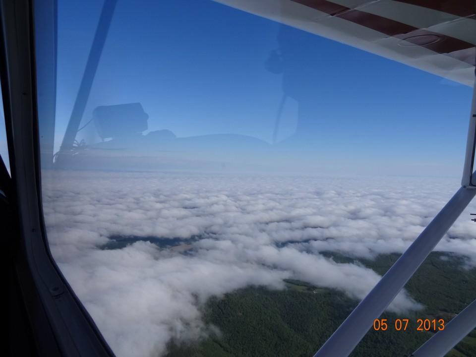
This view looking out the right side of the airplane shows a broken cloud layer
below.
Wendell takes this shot at 9:47 AM looking toward the south from the route of
flight.
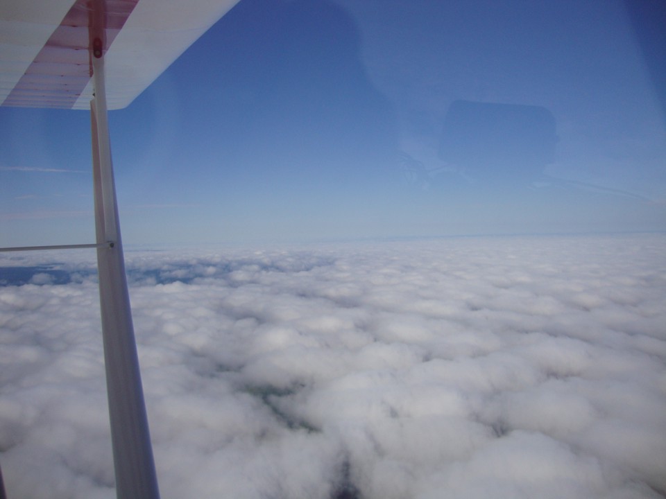
The view looking north is about the same showing the peaks and valleys of a
wave in the cloud patterns. You can see how he aligned his camera with the right
wing brace to the fuselage and not with the horizon in the distance. They are about
50 miles from the Lawrenceburg Airport.
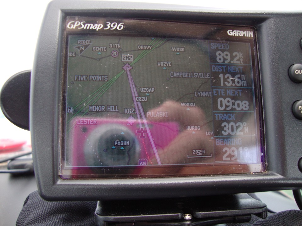
Wendell took this GPS photo at 10:15 AM with just over 13 miles remaining to
the airport.
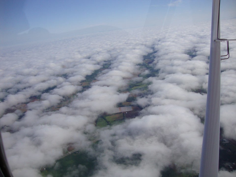
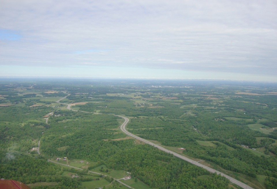
Down below is US 64 pointing the way to Lawrenceburg, Tennessee at 10:22 AM.
Wendell took this photo just before he started the descent and approach to the
airport.
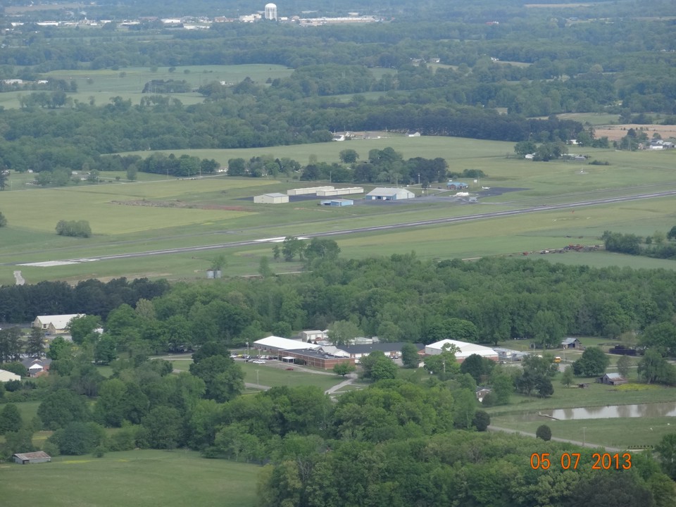
Terry took this telephoto picture of the airport as they fly the base leg to
the runway where they will be landing to the north.
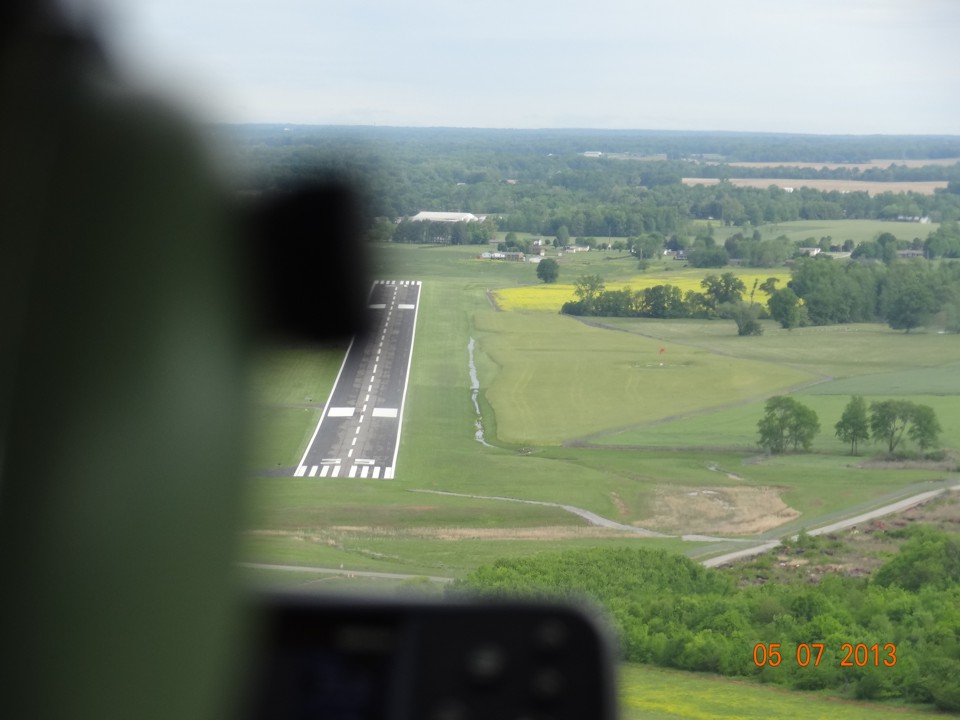
Here is the last photo before turning final approach to runway 35 at
Lawrenceville (2M2). US 64 passes the south end of the airport even with the red
letters of the date on the photo.
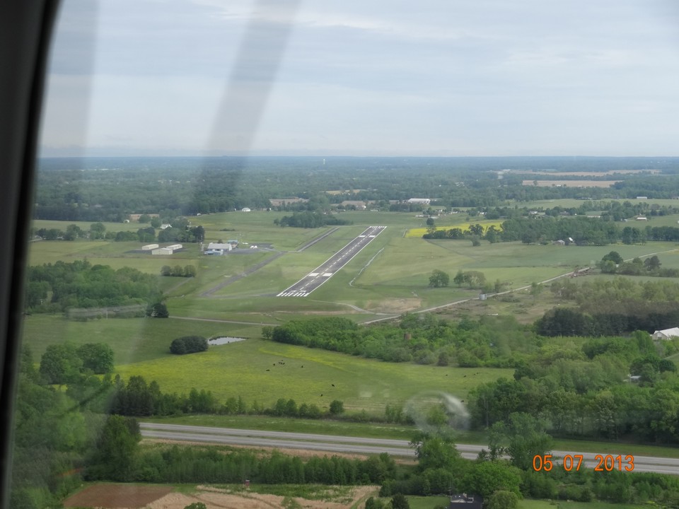
Wendell is getting setup for the landing. That runway is 5,000 feet long,
but from this angle, it appears shorter.
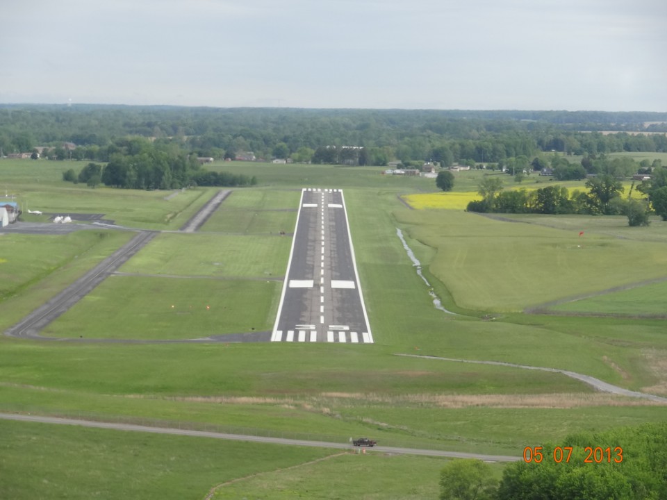
On final approach to Lawrenceburg Airport at 10:24 AM Eastern Time, just 1 hour
and 17 minutes after takeoff from Folks Field near Chickamauga, Georgia. Terry did a
good job with the telephoto setting of his camera on this shot. Since both cameras
have their time set to Eastern Time, I will be using that time for all the photos in these
pages. Lawrenceburg and all points from here to Amarillo are in the Central Time
Zone which started in the next county just west of Chattanooga. A look at the two
VASI lights in the grass left of the runway says they are on glide slope with one light
showing red and the other light showing as white.
| CLICK HERE for Amarillo PAGE 3 | Return to MAIN MENU |