October/November 2021 Vacation Day 16 · · PAGE 51.
November 10, 2021: Wednesday continues
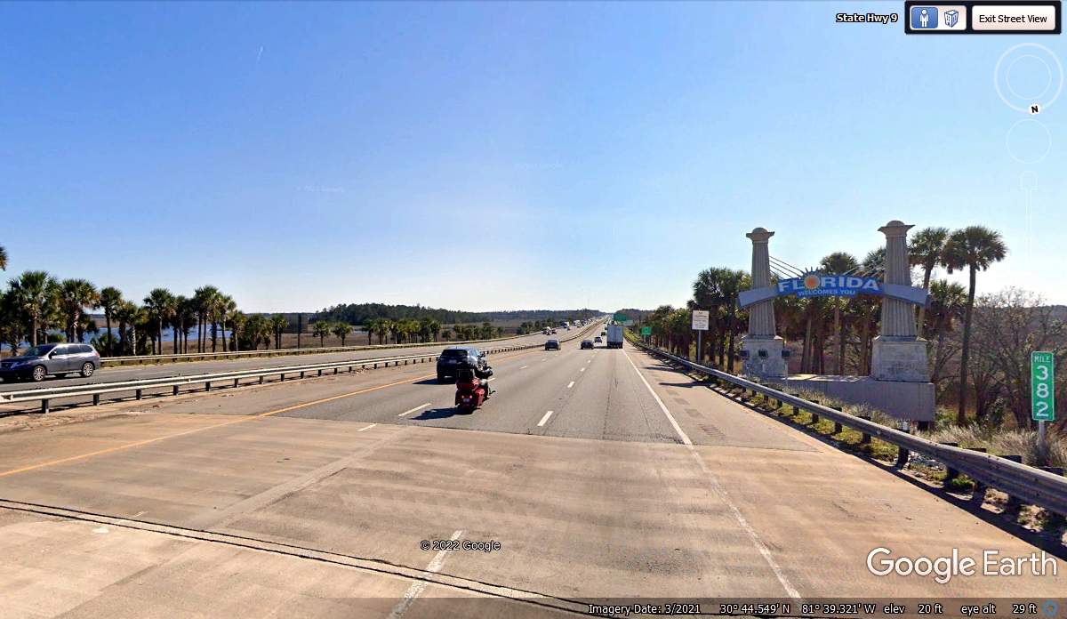
going south into Florida. This is the state line sign so many tourists
look for as they come to the Sunshine State of Florida. This image is at
the south end of a bridge across the Saint Mary's River which is the natural
border between Georgia and Florida at this point. The blue water seen
through the trees at the left side of this image is part of the river as it
winds around this location. This mile marker at the right side of the
image shows it is 382 miles to the END of Interstate 95 near the south side of
the city of Miami where it connects to US 1. US 1 goes all the way down to
Key West in the Florida Keys, but that is another story.
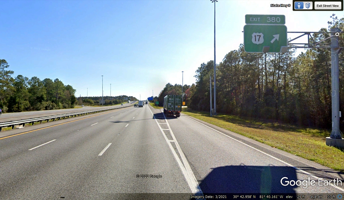
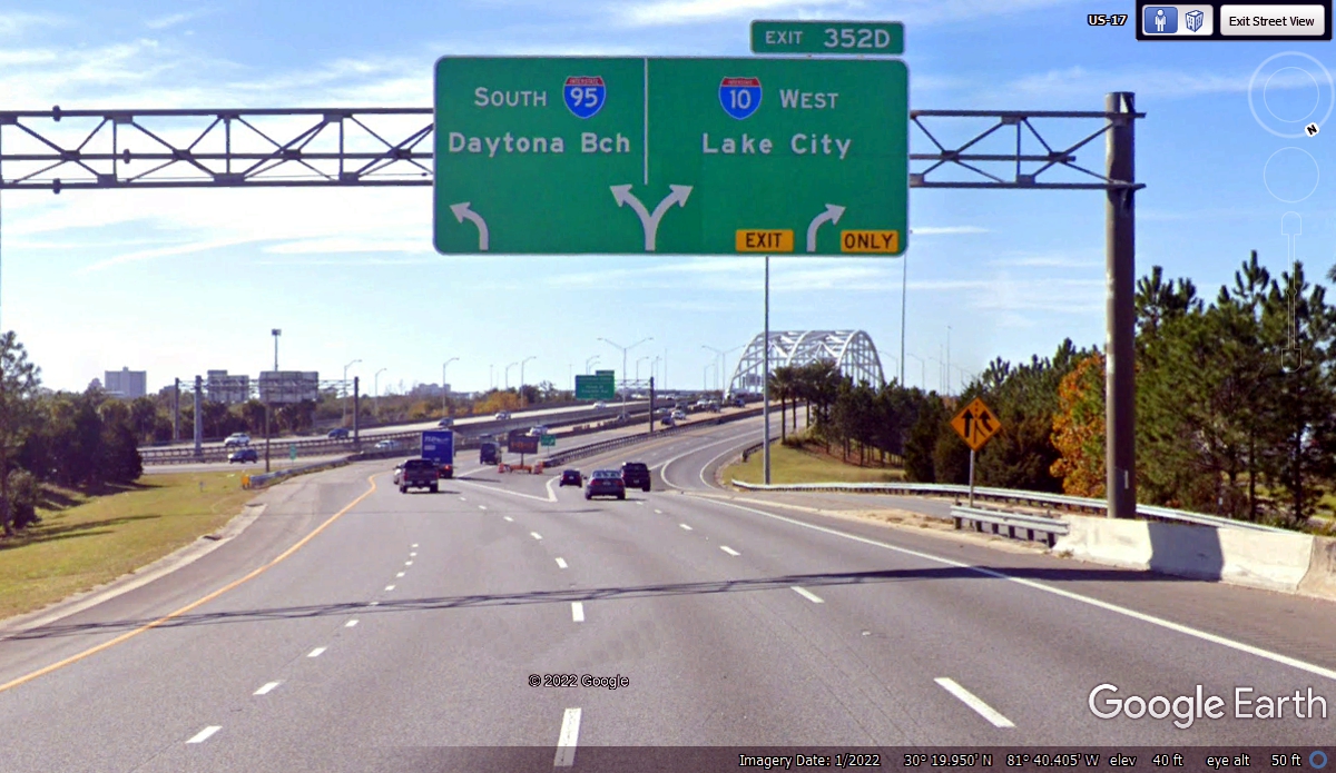
I mentioned how US 17 and I-95 would cross paths in Florida. Here is
the first encounter just 2 miles south of the state line. US 17 is headed
toward Jacksonville, Florida.
After passing the exit to the Jacksonville International Airport, this
sign about the I-95 bypass around the city offers East Side, West Side, or drive
through the city which is what we did on this day heading for home.
The next big route choice is near the city center of Jacksonville.
The LARGE road signs on the pavement minimize the chances of drivers being in
the wrong lane when the routes divide ahead. Although US 17 is not painted
on the roadway, Google Earth has tagged this image as US 17 along for the ride
before it heads south from Jacksonville to Orlando, inland away from the Atlantic
Ocean.
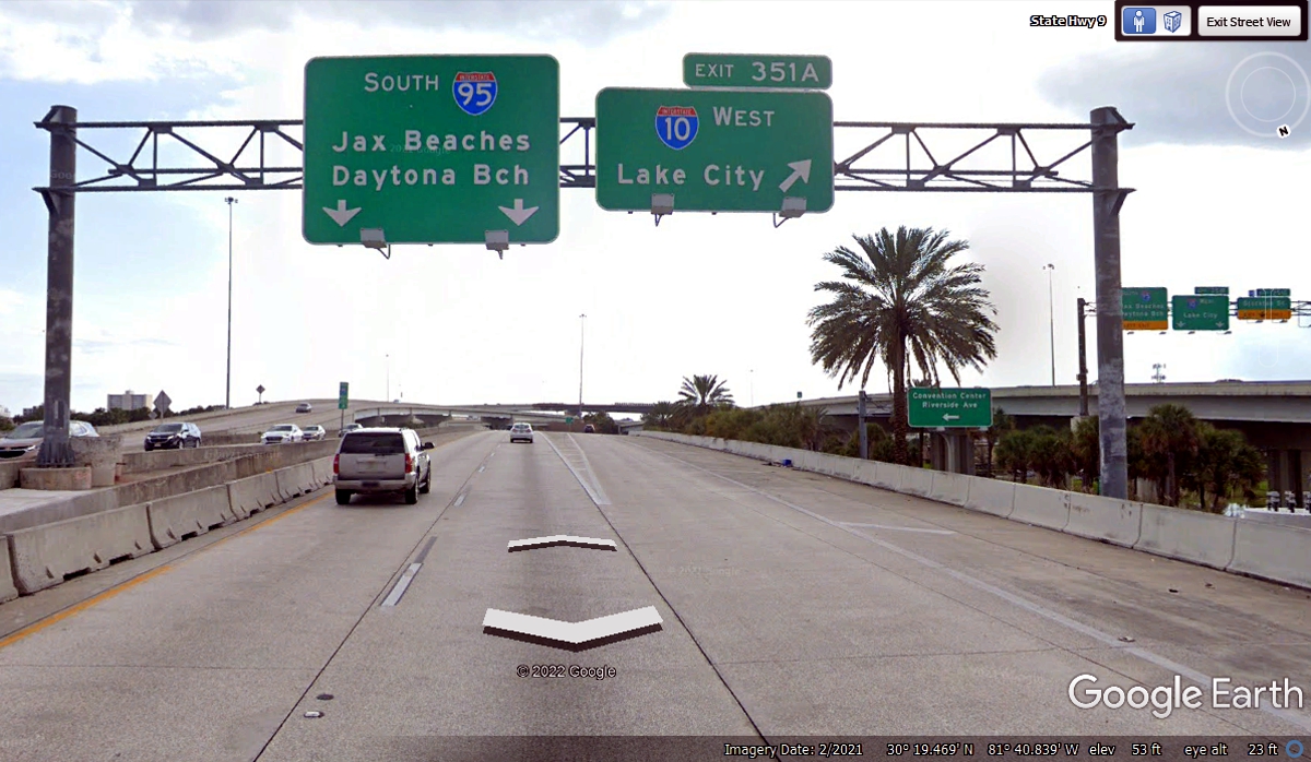
Most everyone looks at the overhead signs when approaching a major
interstate highway junction. From this vantage point, each driver can see
the divide in the roadway ahead.
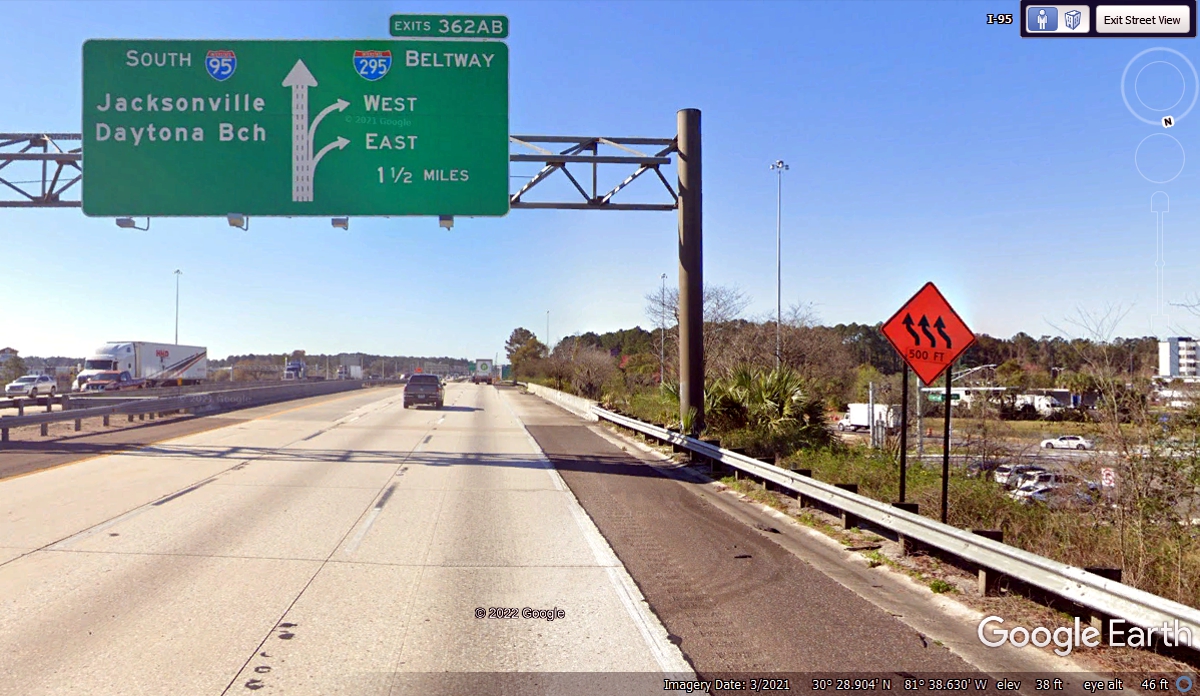
These LEFT lanes are for I-95 southbound, but just in case a driver is
over here wishing he was getting on I-10 heading WEST, here is one last chance
to get there. Interstate 10 goes all the way to Santa Monica on the
Pacific Ocean in the Los Angeles area of Southern California.
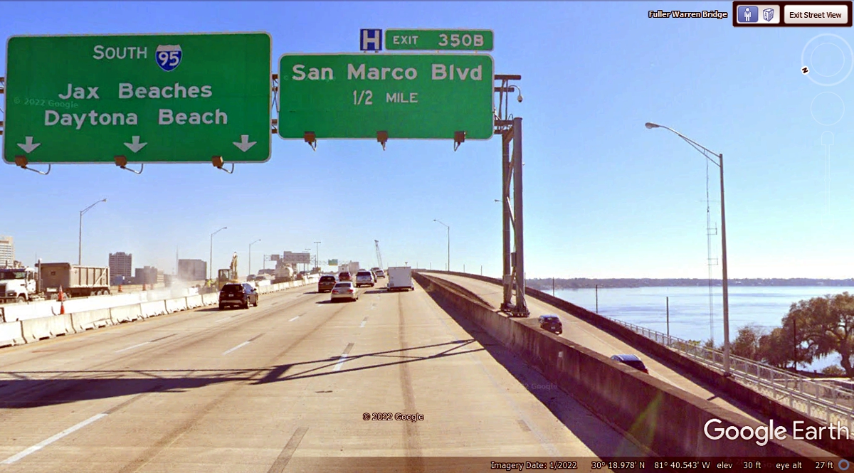
If you have worked your way through the I-95 / I-10 split properly, you
will be on this approach to the Fuller-Warren bridge across the Saint Johns
River seen at the right side of this image. It is one of a few rivers in
the USA that flow NORTH before reaching the Atlantic Ocean which is EAST of
Jacksonville and the big US naval base out there. For now, keep left in
one of the three lanes and follow the Daytona Beach sign at the next split if
you are heading south.
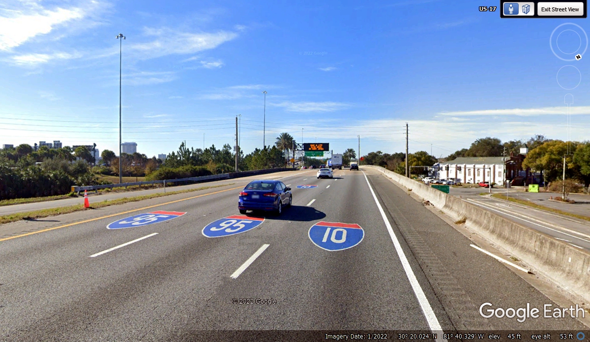
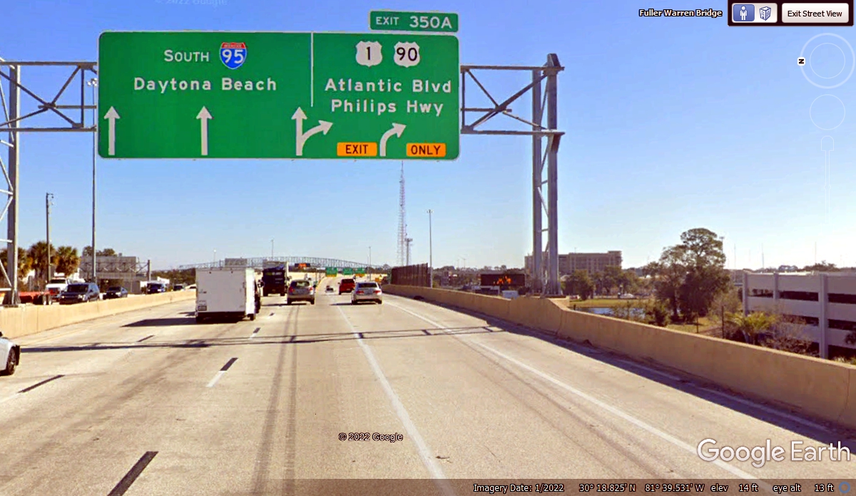
Here is the other sign which will get you out of town, but which
way? Daytona Beach on I-95 is for most of the THRU traffic to all cities
on the East Coast of Florida. US 1 is Phillips Highway and an old local
route all the way down to Miami and Key West if you want to see a lot of OLD
FLORIDA. US 1 runs more or less parallel to I-95 so you do not have to
make that decision here in JAX, which is the three-letter code for Jacksonville
International Airport. If you want to see the nearest beaches, take US 90
East to Florida route A1A.
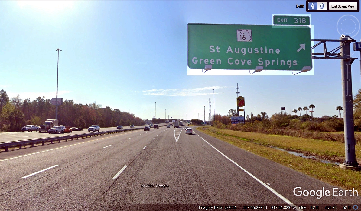
The next town south of Jacksonville is the oldest city in the USA that was
established by the Spanish colonists when Florida was claimed by them. I
am speaking about Saint Augustine. One of the things some folks think
about is these two factory outlet open air malls on opposite sides of Interstate
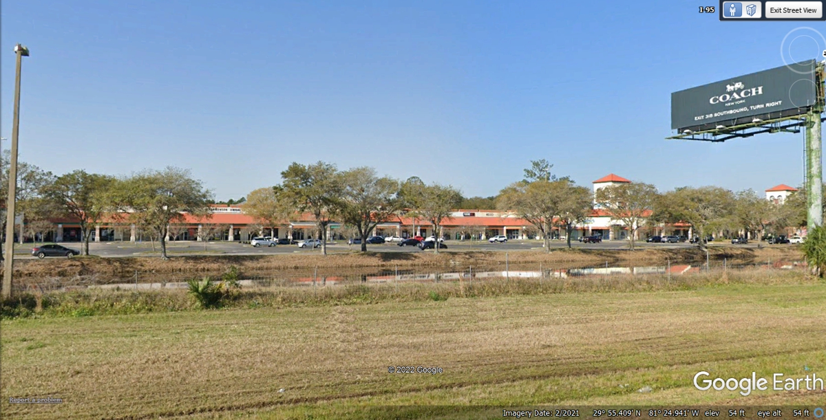
95. Here is the west side of the highway
Here is the East side of the highway with another mall.
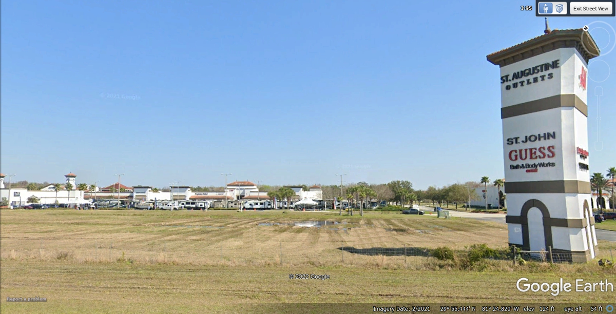
IF you like browsing factory outlet malls, I-95 Exit 318 near Saint
Augustine, Florida has two of these outlet malls with one on each side to the
interstate highway. The morning sun on the Google Earth camera car
required some processing of the image below to make the sign more legible.
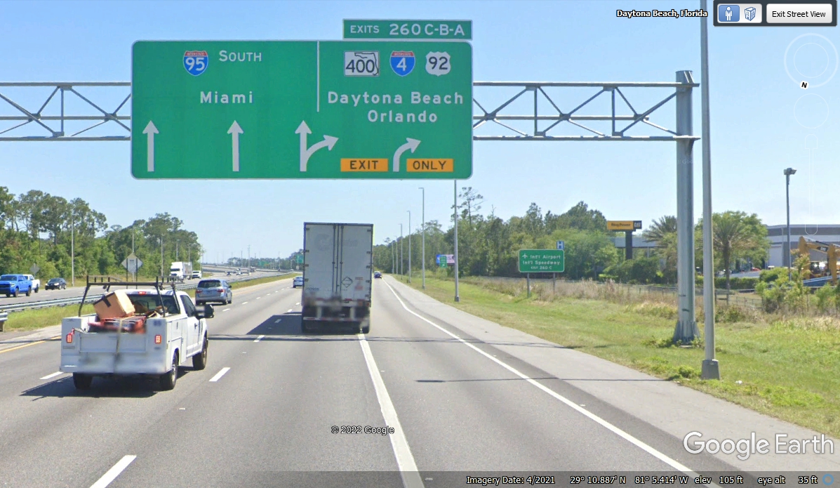
The next big intersection on I-95 in Florida is where I-4 starts at
Daytona Beach and goes to Orlando, Lakeland, and to the big cities of Tampa and
Saint Petersburg, Florida on the Gulf Coast of Florida. We are going south
on I-95 to bypass Orlando traffic as we go back to the Saint Cloud and Kissimmee
area.
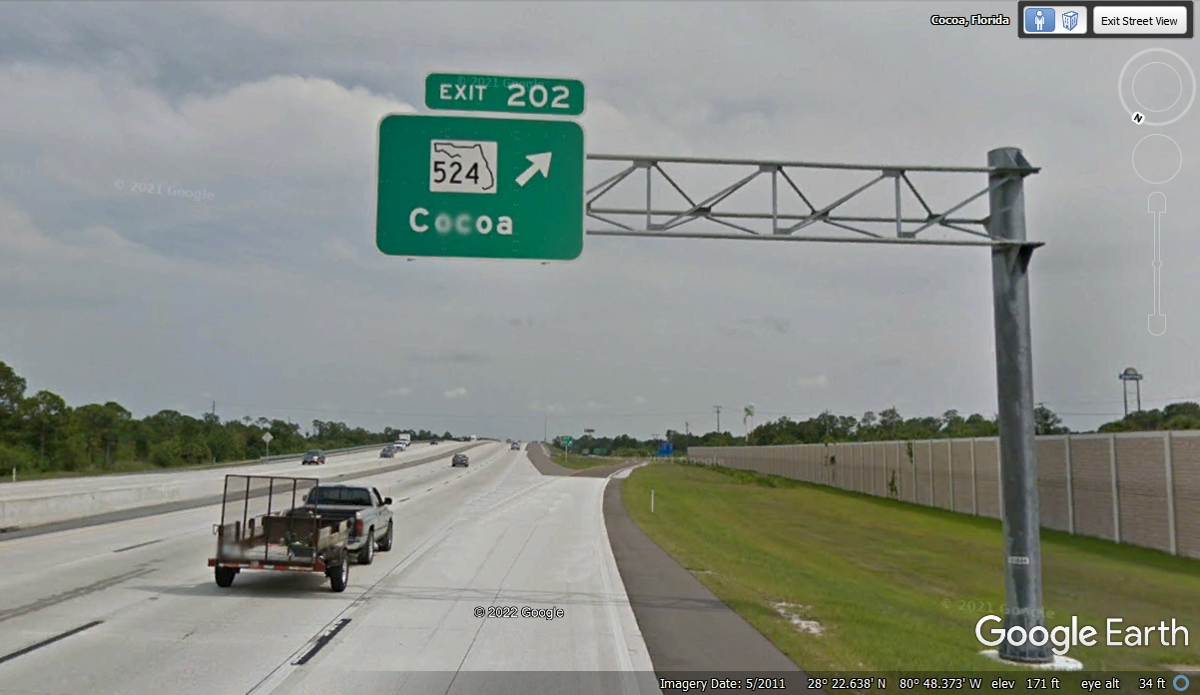
Getting off at EXIT 202 is route 524 where a right turn is a short route
about half a mile to Florida 520 that goes west about 3 miles to the Saint Johns
River as the border between Orange County and Brevard County this far south of
Jacksonville where the river is much smaller.
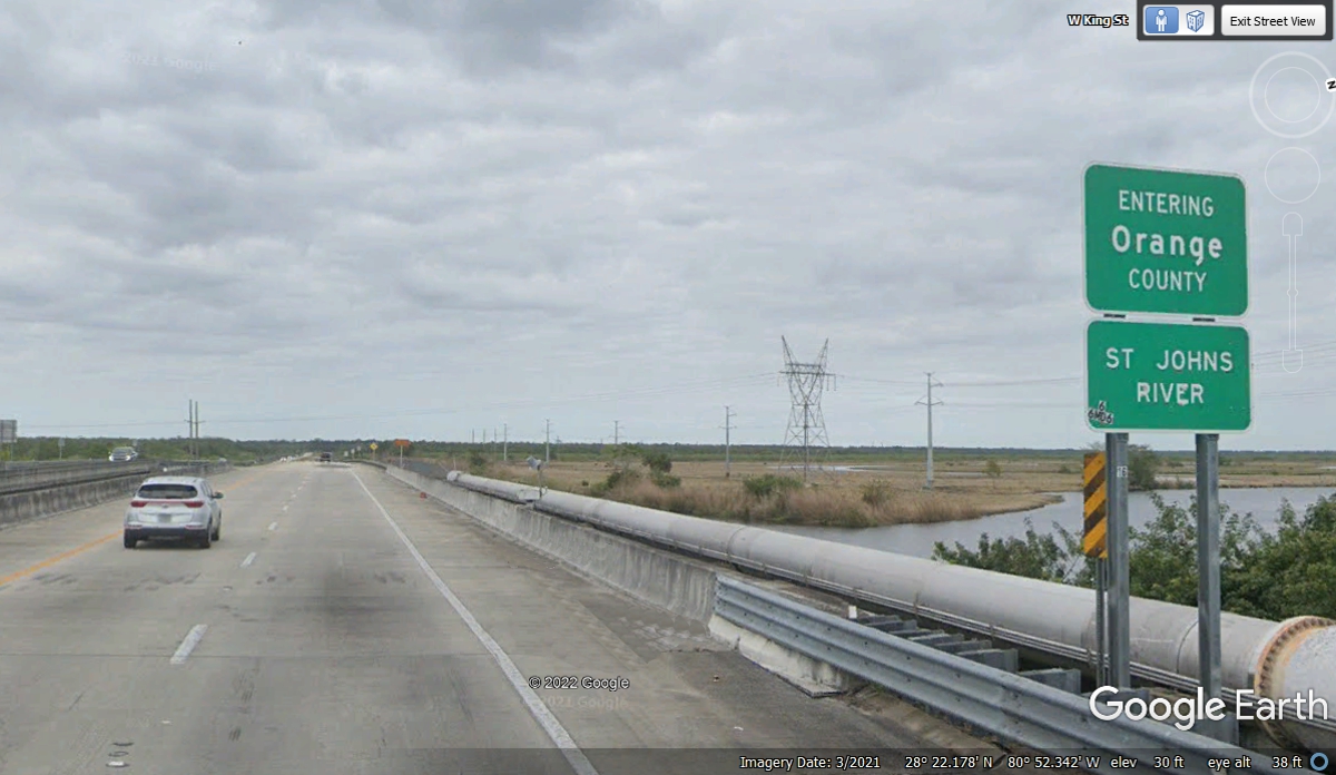
Here is the county line crossing the Saint Johns River into Orange
County. The last county road we take getting closer to home is only about
3 miles to the WEST of the Saint Johns River and it is county road 532.
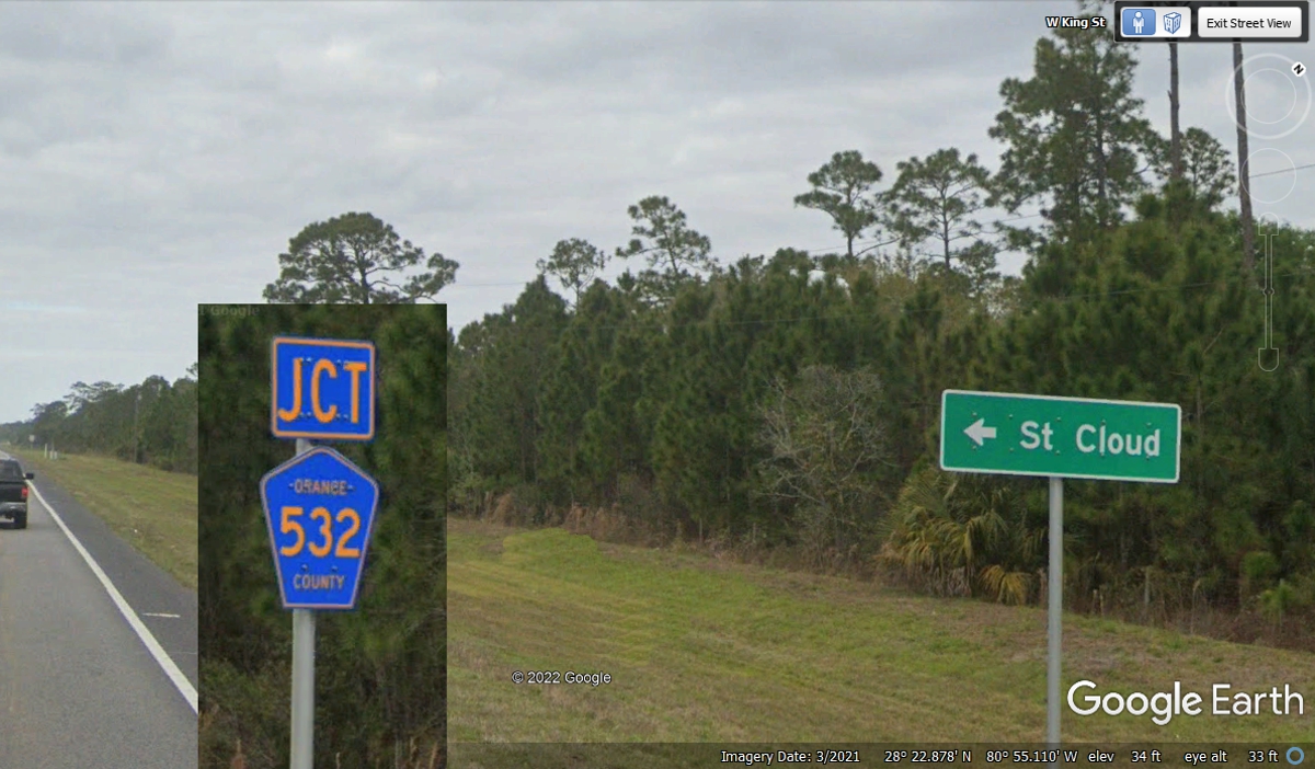
Here is a combined image showing a green sign indicating a LEFT turn ahead
leaving County route 520, where the LEFT turn is onto County Route 532 that runs
for 26 miles until it ends at US 441/US 192 on the East side of the town of
Saint Cloud, Florida.
This end of the road starts at this intersection in Orange County, the same
county where Orlando
is located. At this point route 532 is going almost due south.
The change in the color of the asphalt of the road defines the county line
where Osceola County begins the maintenance to County Road 532. The Google
Earth image below is from 2019 and did not show the county sign. I had to
jump over to US 192 entering from Brevard County to cut and paste the sign seen
here.
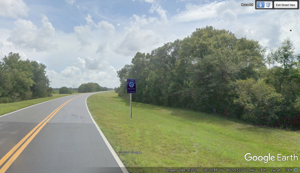
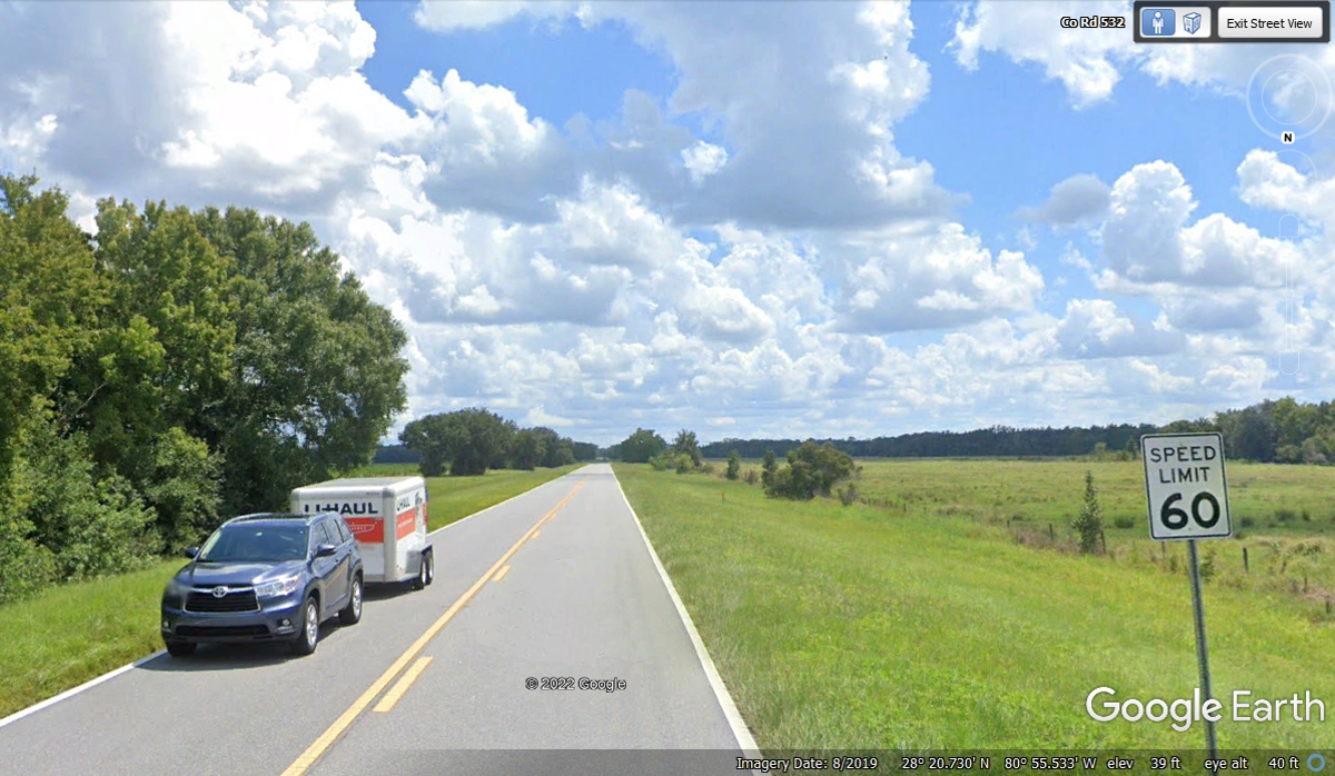
This Google Earth image is looking south to show the speed limit sign
facing north to traffic that just started down the road from Orange County into
Osceola County.
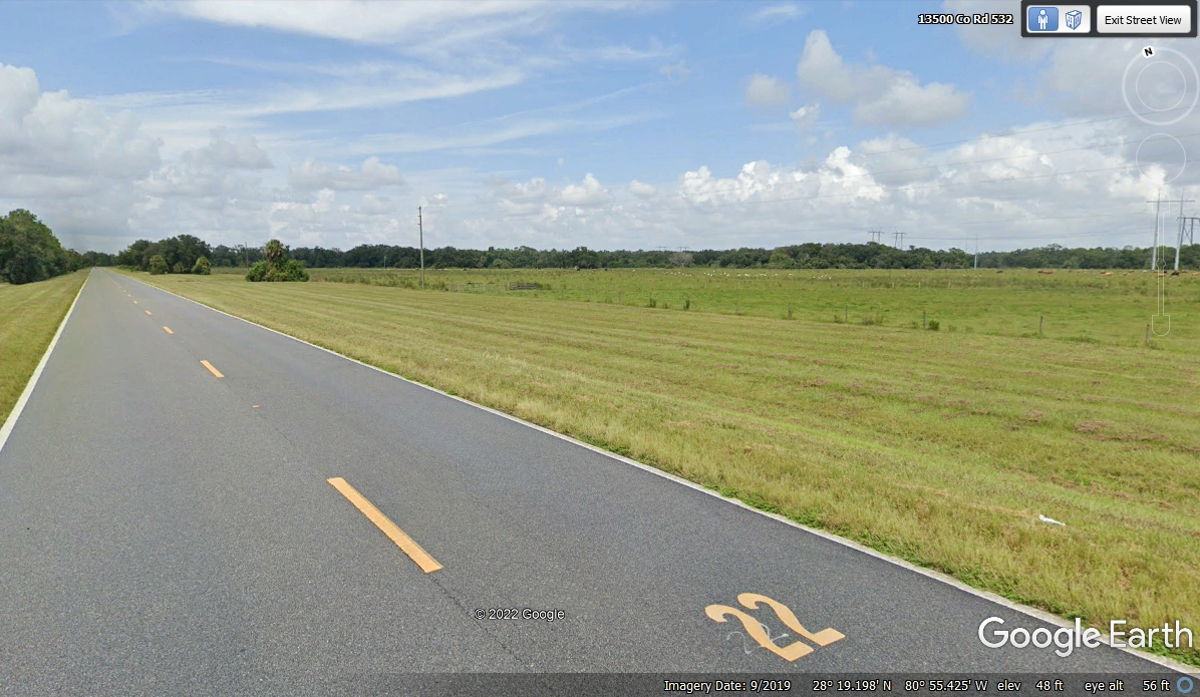
One of the things the county did was to put mile markers on the surface of
the road counting down to the southern end of the road at US 192. This is
the second sign inside the county that is in better shape than the numbers at marker
23.
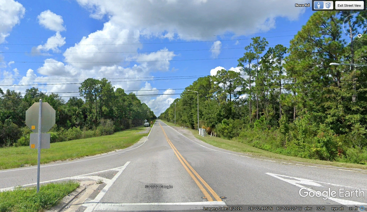
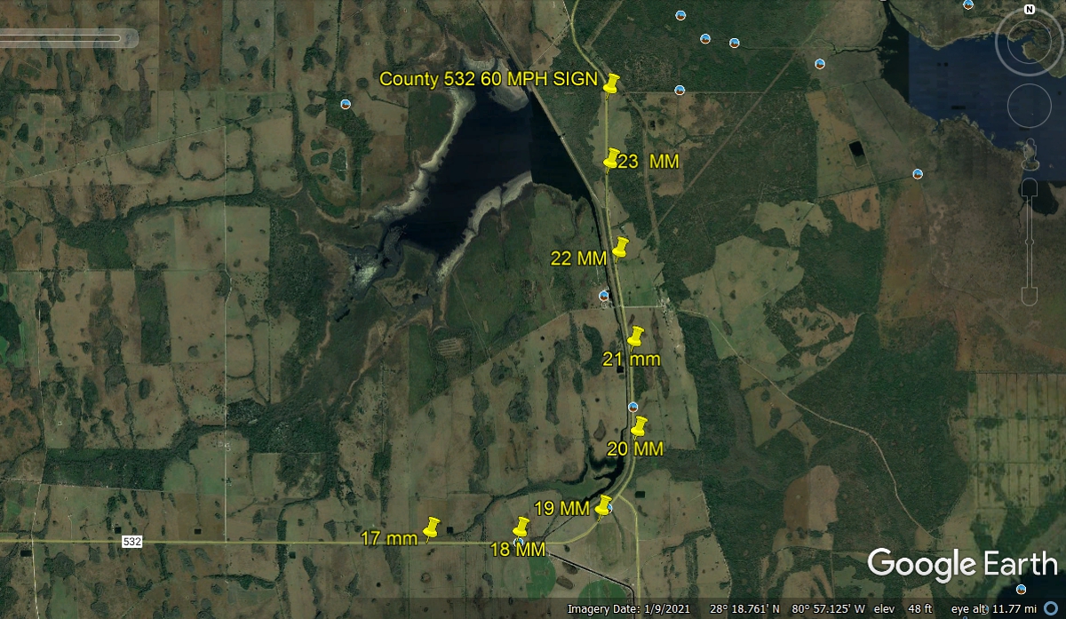
I placed push pins at the locations of the painted mile markers on this part of
Florida County road 532, also known as NOVA ROAD by the locals.
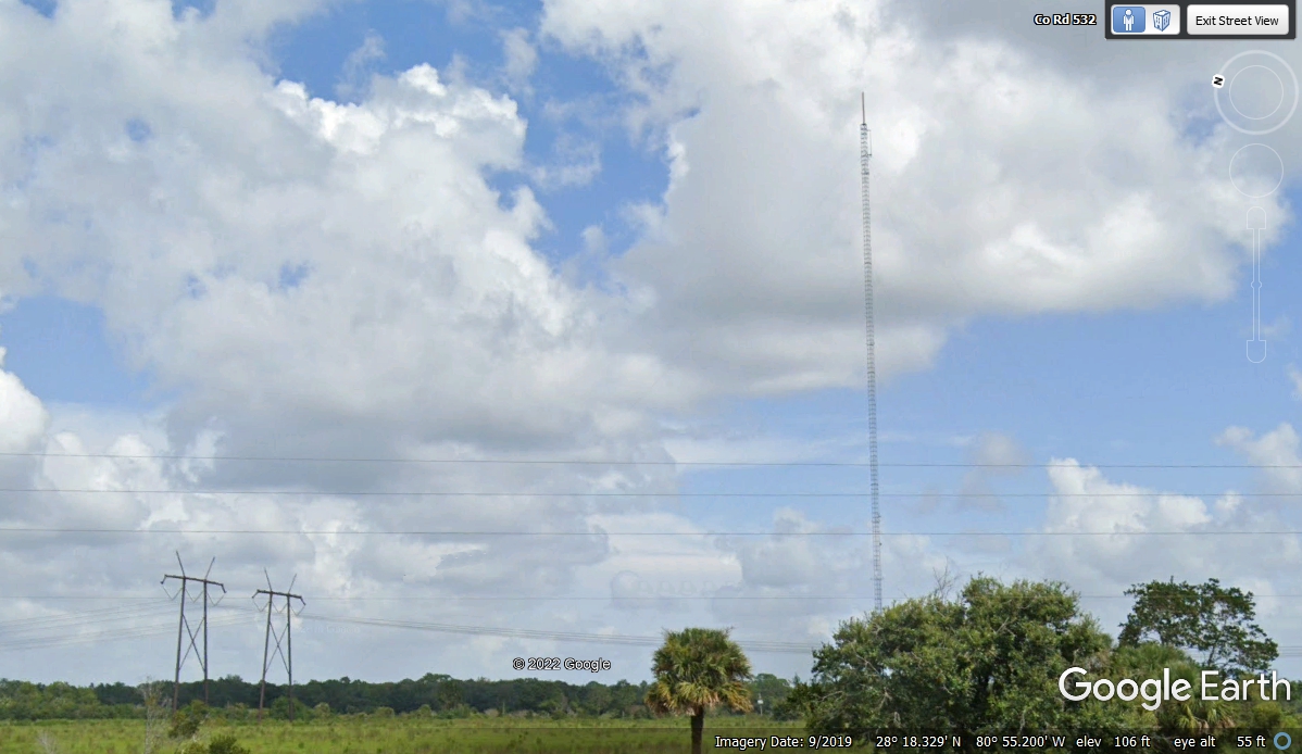
I have been in the CATV, TV Broadcast, satellite, and fiber optics
communications industry since 1971. I have seen a lot of TALL television
towers in my lifetime. There are a couple of those towers accessed from
Nova Road. This TV tower is less than half a mile East of route 532 near mile marker 21 with a UHF antenna at the top of the tower. This location
is between Orlando and the Melbourne / Brevard County communities. Those
large electric power line towers connect a few power plants together from
several areas of Florida.
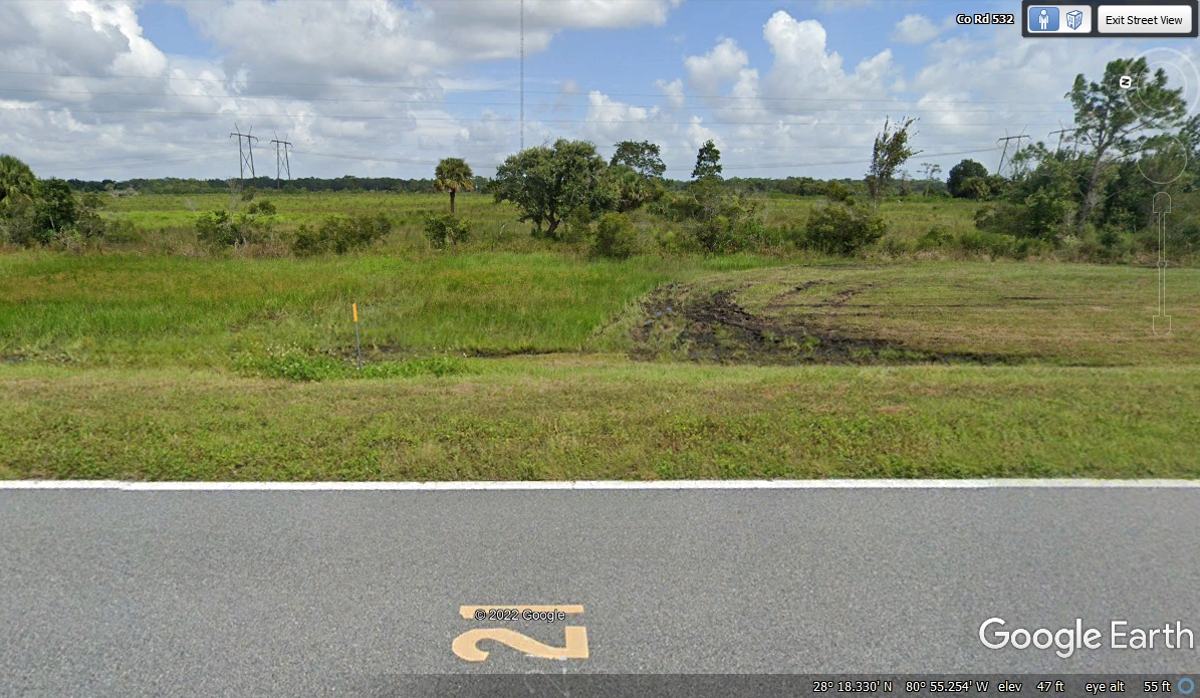
Here is the same camera angle but the magnification set to minimum for
wide-angle imagery that confirms the tower is visible from mile marker 21.
Just so you know, that white line is the edge of the pavement on route
532. It is not a divider between two photos. That orange marker
about 2 feet above ground level is for a buried telephone cable near the edge of
the right-of-way for the highway.
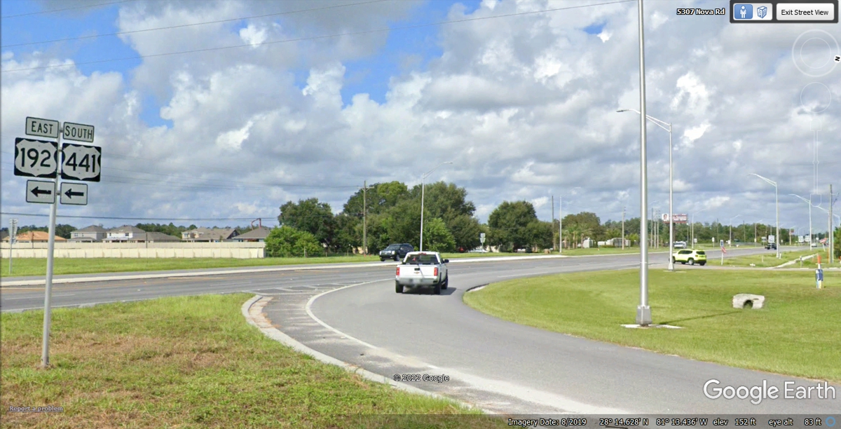
Jumping ahead to the ZERO mile marker location is the end of Nova Road at the
junction of US 192 and US 441 East of the city of Saint Cloud, Florida. We
turned right here at 1:49 PM to head WEST, the real direction of this part of the route,
takes us to the end of our journey that began October 26 and ends here on
November 10 for a 16-Day trip to new horizons and back to HOME!
This is the view heading west after the first traffic light on the East
side of Saint Cloud, Florida. This place is about 6.4 miles from home with
stop lights and cross streets ahead.
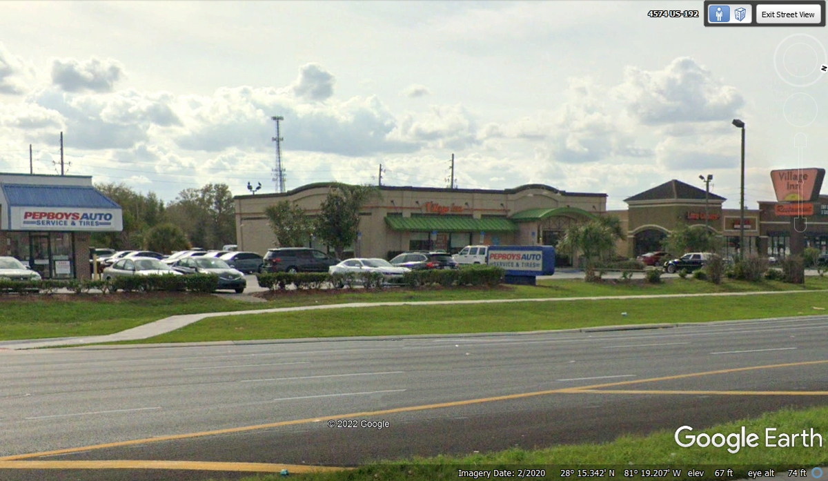
The feeling of being home is when you pass by one of your favorite
restaurants like this Village Inn, and the Pepboys Auto next door where I
recently bought new tires for my RAV 4 after 63,000 miles on the original
factory-installed tires. A hostess at the restaurant is married to the
manager of this Pepboys location.
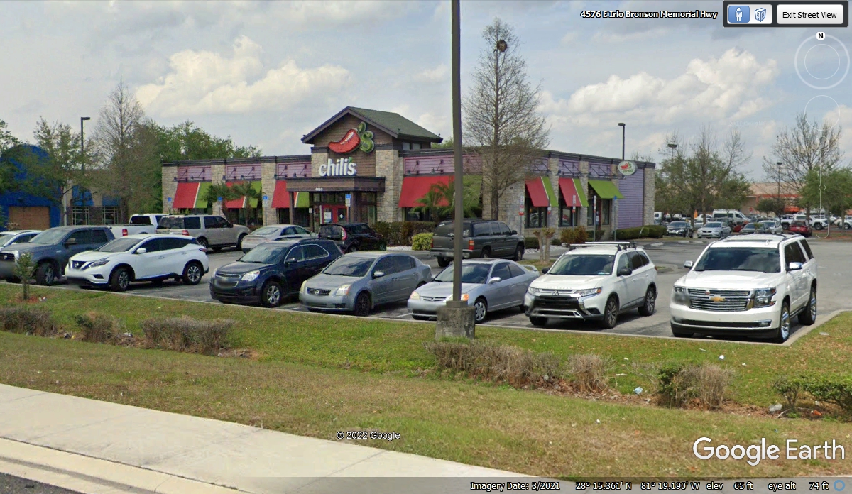
Directly across the highway is this Chili's restaurant where I picked up
take out meals when the Covid-19 Lockdown began. I would order our meals
online and pick them up at the take out door. We still order our take out
meals once every week from here.
The other steak house not far from home is this OUTBACK Steakhouse
that is next to where the Florida Turnpike crosses US 192 and US 441 near the
Kissimmee/Saint Cloud exit from the turnpike 1.5 miles from here to the west.

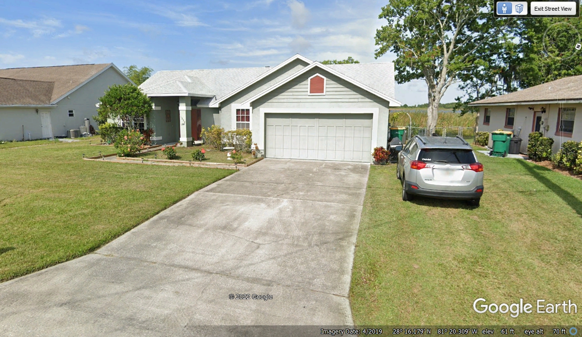
There is no place like home! Engine off at 2:10 PM in the
driveway. Traffic was stop and go through Saint Cloud. The the last
two miles were easy.
| RETURN TO 2021 VACATION MENU |