October/November 2021 Vacation Day 5 · · PAGE 8.
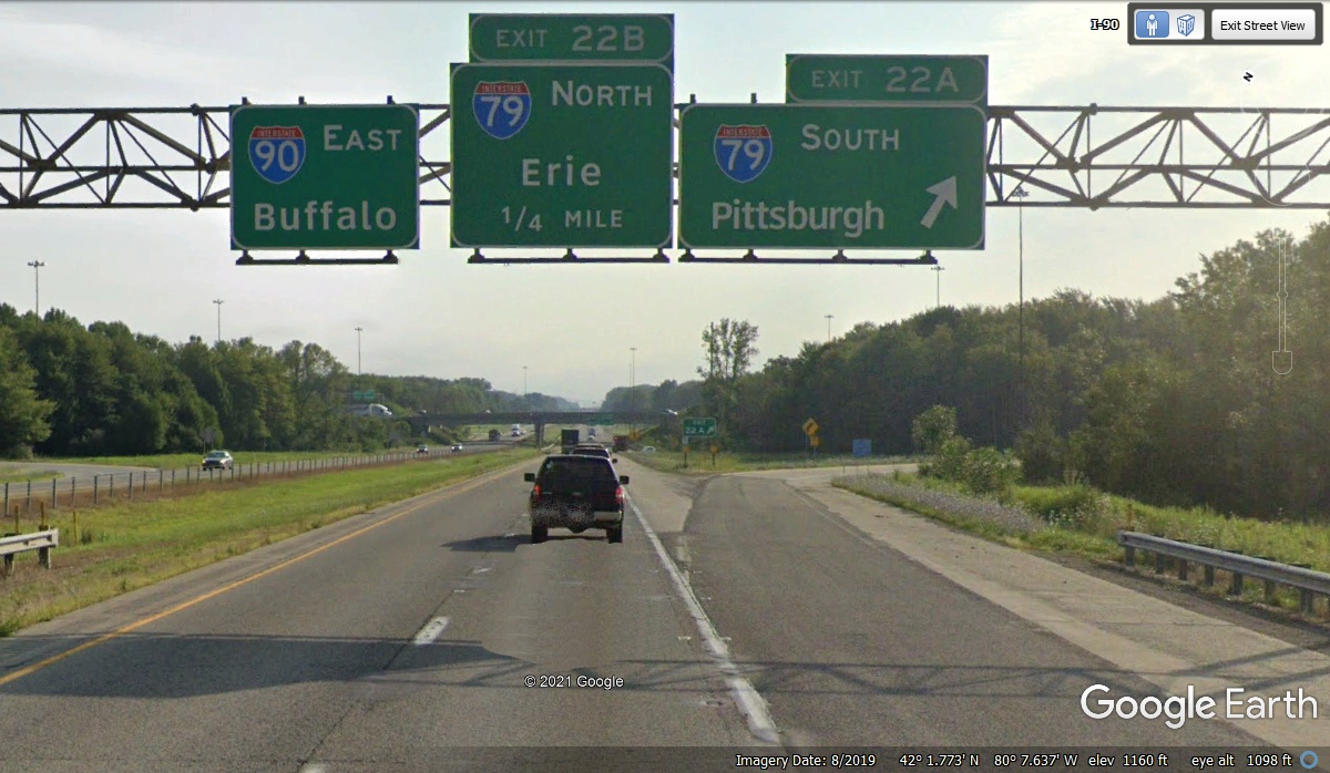
October 30 2021: Interstate 79 comes up from Charleston, WV via Pittsburgh, PA and ends in the city of Erie, PA. This exit is 22 miles from the Ohio/Pennsylvania state line. We passed under these road signs at 11:14 AM on Day 5 of our 2021 Vacation.
The first time I passed by this location on Interstate 90 I was on a company road trip in the 1980's from Ocala, Florida to Toronto, Ontario in Canada. I came up US 301 from Ocala to join I-95 north of Jacksonville, FL. From there, I crossed southeast Georgia into South Carolina before heading north on I-26 up to Columbia, SC. I-77 begins there then goes north through Charlotte, NC crossing the Virginia "pan handle" into West Virginia. When I reached Charleston, WV my route north on Interstate 79 brought me to this intersection. I-90 East took me to Buffalo, NY where I crossed into Canada for the short ride up to Toronto. I was towing a tandem-axle trailer with a transportable 5-meter satellite antenna on it.
By the time I went from Florida to West Virginia, I had to stop and get a
repair to one of the axles on the trailer. I had noticed that the left tire
on the front trailer axle was damaged and needed a repair. I stopped for
fuel and asked the guy running the gas station if he knew of a nearby garage
with welding tools who could straighten the bent axle. He gave me
directions to the shop and the guy there said "NO PROBLEM" then took that
wheel off and used his welding torch to heat up the axle to a glowing red
color. He had a steel pipe he slipped over the end of the axle and applied
pressure to line up the outer part of the axle with the remaining length going
to the wheel on the right side of the trailer. When the axle cooled down,
he put the wheel bearings back to where they belonged, lubed the bearings, and secured the wheel for
travel. If I remember correctly, he only charged me $50 for his
labor. I got back on the interstate and kept checking the worn tire to see
if I also needed to replace it. The remainder of the trip was un-eventful.
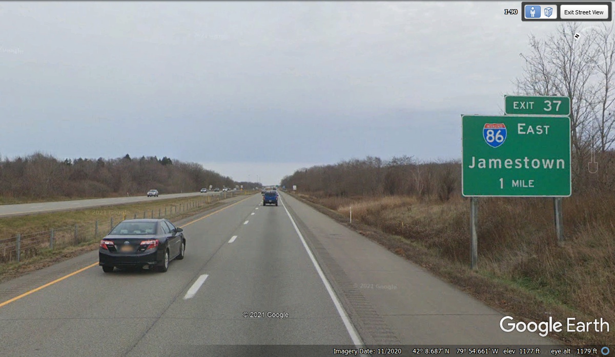
October 30, 2021: Our next route change for this morning is where Interstate 86 begins and
goes East from I-90. It turns out the connection to I-86 is at Mile 37,
just 15 miles from the I-79 connection seen in the photo above. We passed
this location at 11:28 AM. GPS ground track data is great for marking time
and places on the road.
Welcome to New York State
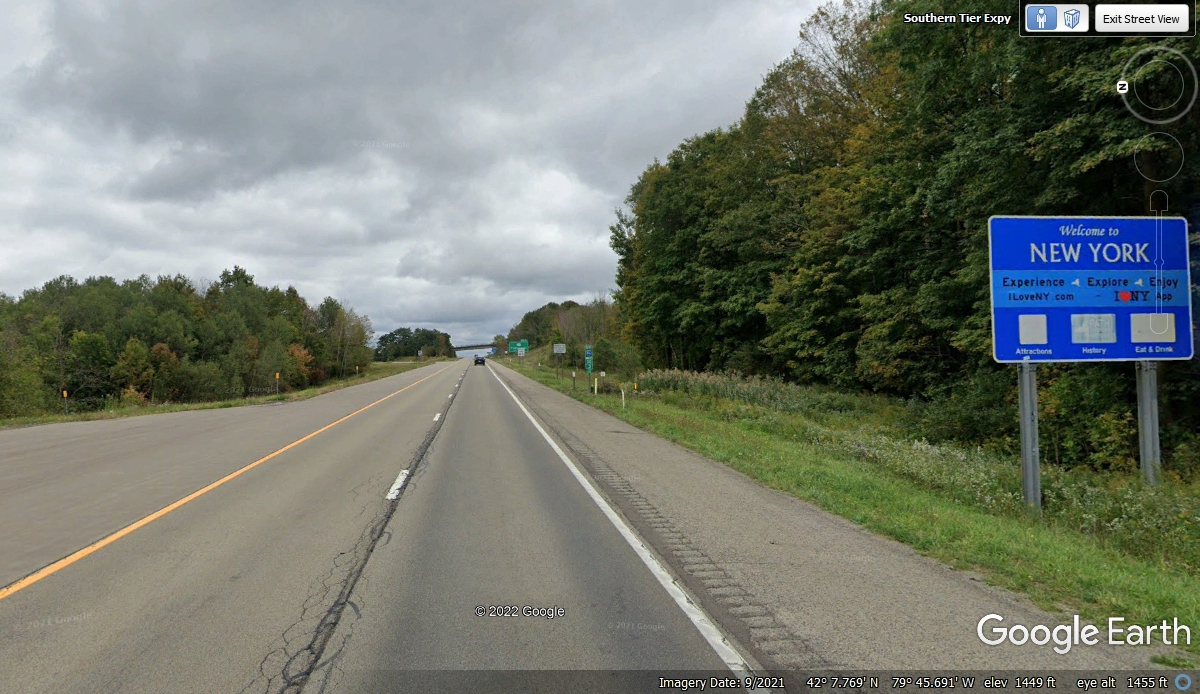
October 30 2021: Interstate 86 enters New York State from the northwest section of
Pennsylvania. We got here at 11:34 AM on this Saturday.
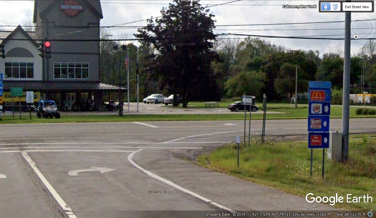
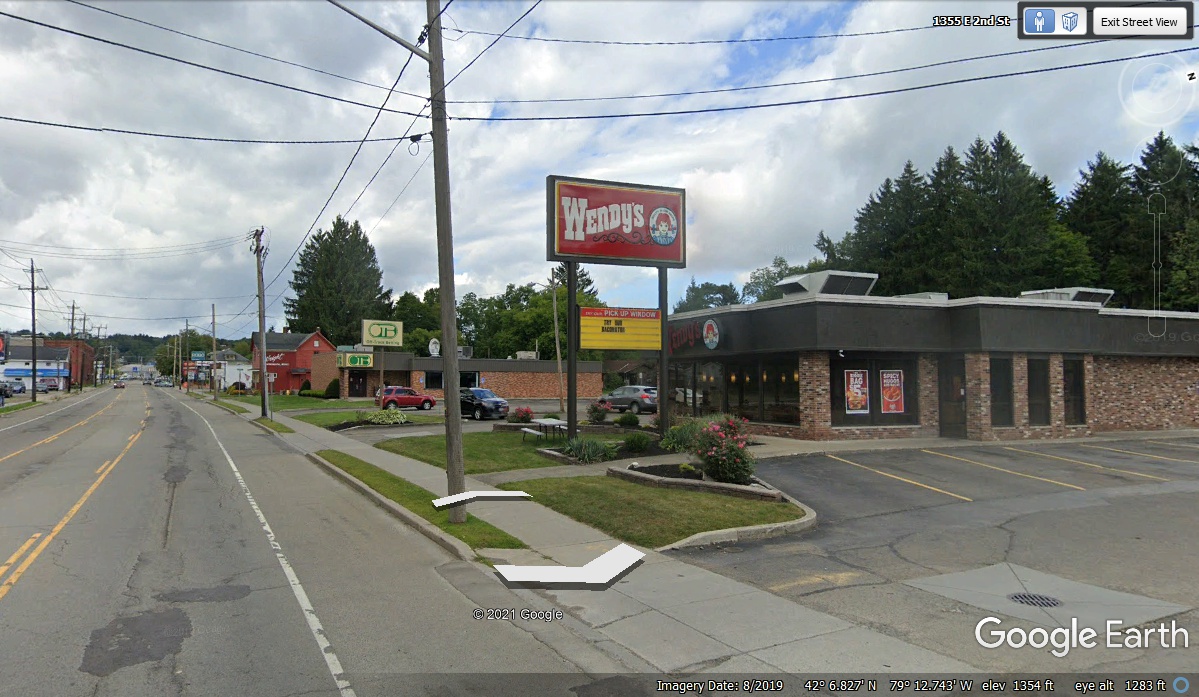
We were coming to the town of Jamestown, NY and debating lunch. I
noticed we had passed two exits to the town and the last one was coming, Exit 13
which turned south to NY route 394 that is running parallel with I-86 at this
point. When we pulled up to the traffic light, we found the sign pointing
to Wendy's and turned right on NY 394 to head into town.
Wendy's was about 1.5 miles from the intersection seen above. Lunch
for day FIVE was here in Jamestown, NY. We pulled into the parking lot at
12:08 PM. We finished lunch and our rest stop was over as we departed here
at 1:06 PM.
We finished our lunch at Wendy's in Jamestown, New York in the western part of
the state. We were surprised when we came to an exit that had a line of
ORANGE CONES forcing all traffic to exit from Interstate 86. This is the end of
the exit ramp that began the detour around flooding of I-86 beyond this point.
We arrived here at 1:45 PM and started the detour over to NY route 417 to get
around the flooded area.
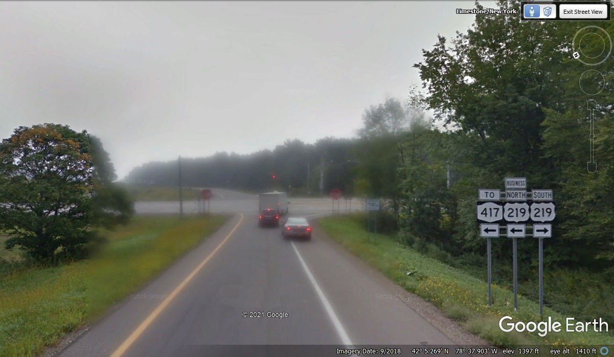
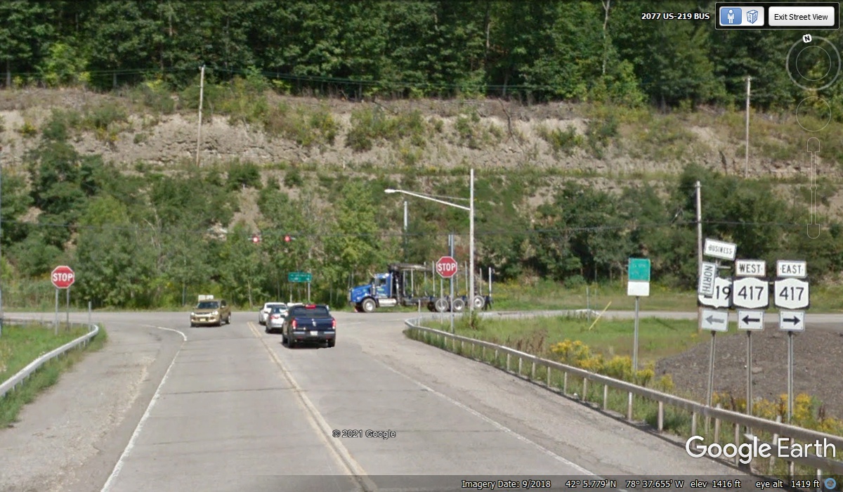
The day we came this way, Interstate 86 had flooding from the Allegheny
River. A temporary DETOUR was set up between Exit 23 and Exit 24 using New
York route 417 which runs parallel to I-86. With the traffic here, it took
two minutes before we got on route 417 and continued our Eastbound trek.
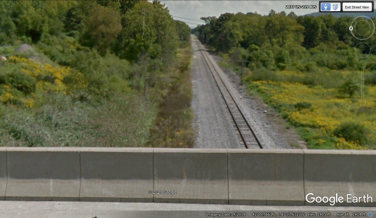
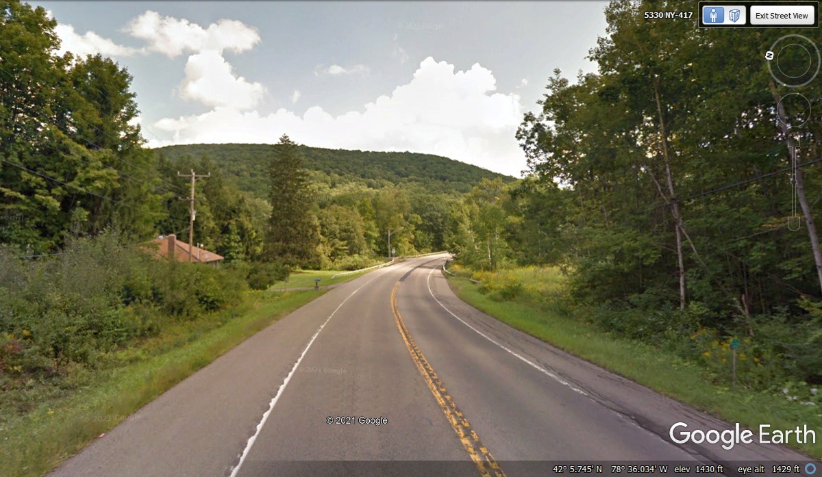
Looking to the right from the Google Earth camera location of the image
above shows a railroad track passing under this bridge on higher ground, which
can be seen while going over to NY 417. Both are above the normal flood plain of the river. I
had been watching the weather for this area and saw a major low pressure area
and its associated storms passing over this area a few days before we got
here. The nearby mountains created a lot of water runoff that caused the
local flooding causing this temporary detour.
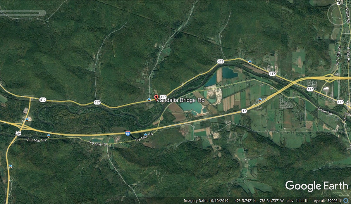
I looked at the elevation change along NY 417 used for this detour
route. Google Earth indicated a high of 1440 feet at the intersection
where we turned East and around 1420 feet at the lowest point before reaching
the end of the detour. This Google Earth image below is from September
2018 with little traffic when it is not being used as a detour adjacent to
I-86. The traffic we saw today was not that much as the amount of
westbound traffic we saw on I-86 was nothing like you would see on a major
interstate highway like I-90 or I-75.
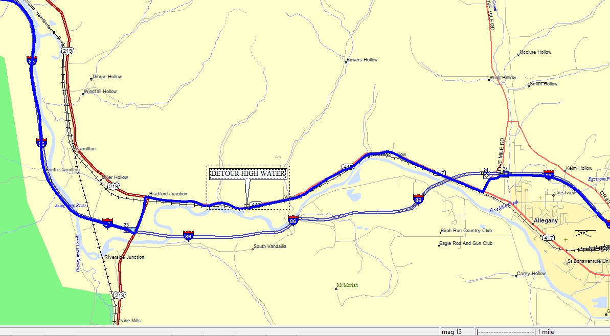
The length of the detour from Exit 23 to Exit 24 was about 6.5 miles with
no problems along the path. We got to the on ramp to I-86 at 1:57 PM.
Here is a digital map showing the detour with the town of Allegheny and
the Allegheny River that caused our detour as a result of recent heavy rain
storms. The I-86 Exit numbers 23 and 24 are clearly visible on this
map. The map also shows some nearby smaller rivers and streams that flow
into the Allegheny River.
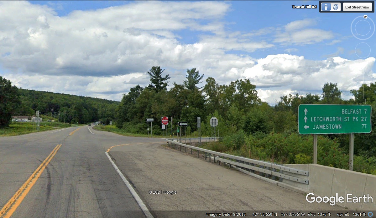
Exit 30 on I-86 is where we turn north on NY route 19. Our nest
planned stop
today is Letchworth State Park. The exit numbers on this route are not the
mile marker numbers.
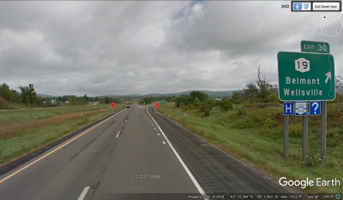
This road sign with mileage to our next stop was conveniently located on
the bridge that crosses over the interstate highway. It also points back to
Jamestown where we had lunch. We are now heading north on NY route 19 at 2:22 PM.
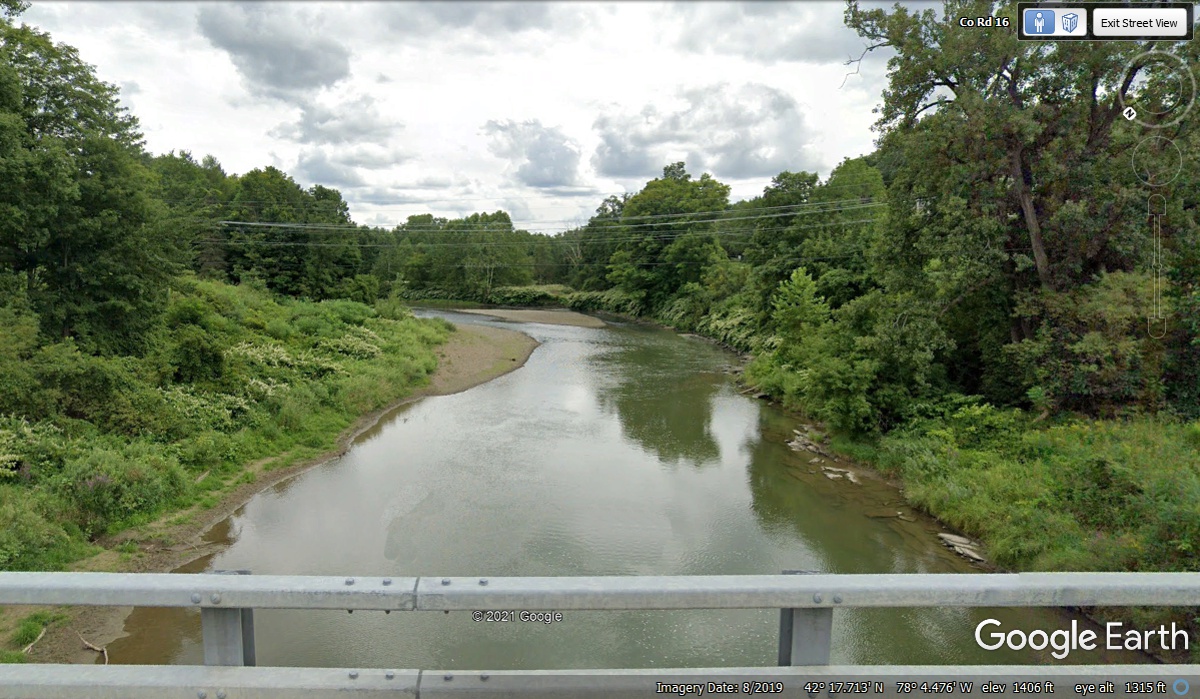
When we made this trip up to Letchworth State Park on October 30, 2021, I
noticed the source of the waterfalls was the Genesee River. As I
create this page today, November 30, 2021, I discovered the Genesee river is
running NORTH parallel to NY route 19. I wanted to show the size of the
river at this bridge that crosses the river about 25 miles south and UPSTREAM
from the state park.
| RETURN TO 2021 VACATION MENU |