SMOKY MOUNTAINS NATIONAL PARK · · PAGE
11.
November 17, 2020: When we came back to
the motel with breakfast, both door keys would not unlock the door. I went
down to the office which of course was closed this early in the morning. I
called the phone number on the door to get the manager/owner to give me some new
keys programmed for today. We ate our breakfast snacks, packed the car,
and hit the road for today's adventure.
Tuesday was looking
good as we got started at 8:33 AM. There was a little bit of frost on the
windshield that was easily removed by the windshield wipers and washer
liquid. As I was creating this web page today (December 8, 2020), I
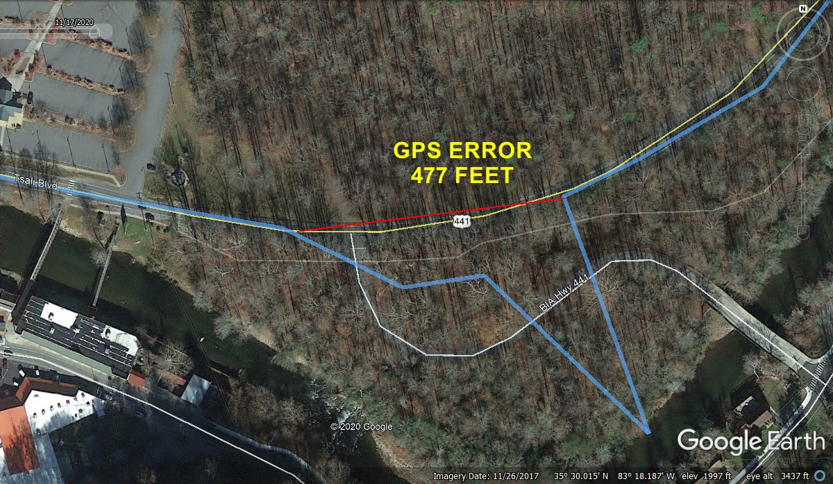
noticed there were three bad GPS data points as we entered the national park
boundary on US 441. The BLUE line is my GPS ground track showing THREE bad
GPS data points as we entered the GPS error with lots of tree coverage which can
reduce satellite reception. I drew the RED line to measure distance while
the signal was off track. I just realized I did not connect to the blue
line accurately on the left end of the RED LINE.
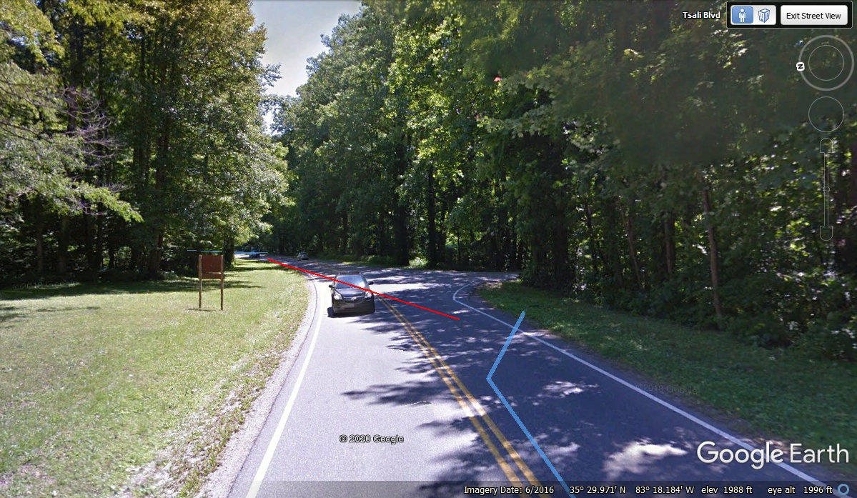
Here is how the area looks from ground level. The RED line here
comes up short in this image, but looks good in the image above looking
down. That RED line error being too short shows up more than above in this
ground view.
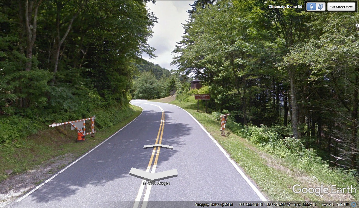
Here is something about the intersection seen in the image above.
The two white "arrows" created by the data from the GPS track from the
Google Earth photo vehicle are usually centered in the travel lane on the
highway. Here the data points are off to the same side as the error in MY
GPS when I passed this way. Oh, well, nobody's perfect. Let's just
enjoy the ride through the Smoky Mountains.
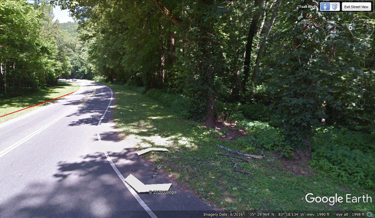
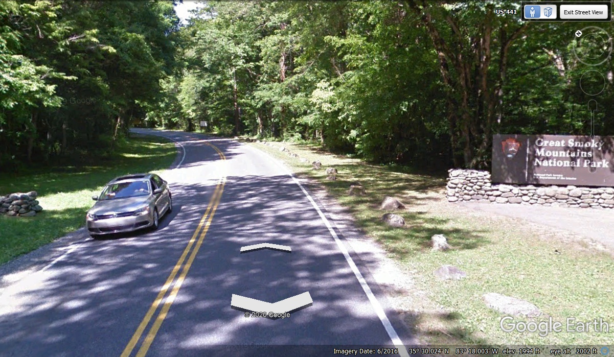
This is the official southern boundary of the Great Smoky Mountains National
Park on US 441. Notice the two "arrows" centered in the lane, which
should be
an indication of good GPS signal reception by the Google Earth camera vehicle on
the day it passed this way gathering so many images of the surroundings.
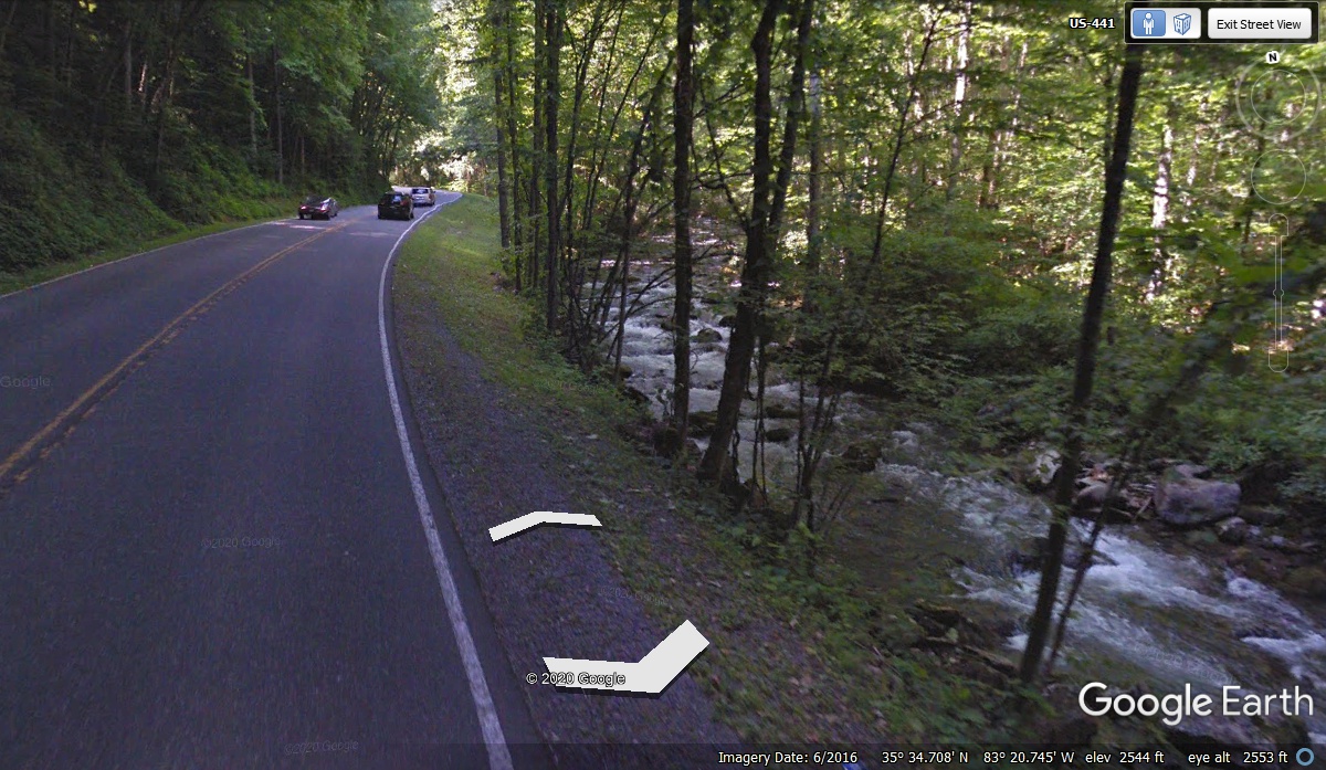
A lot of the area climbing the south side of the mountain has running
streams by the roadway. The running water has been cutting through the
mountain rocks for millions of years. The path for the roads next to the
streams was obvious to the road builders. The reason the white
"arrows" from Google Earth are on the side of the road and not in the
travel lane is because I changed the viewing angle to get the mountain stream in
this image. The arrows are only centered in roadway when the
"camera" is pointed forward.
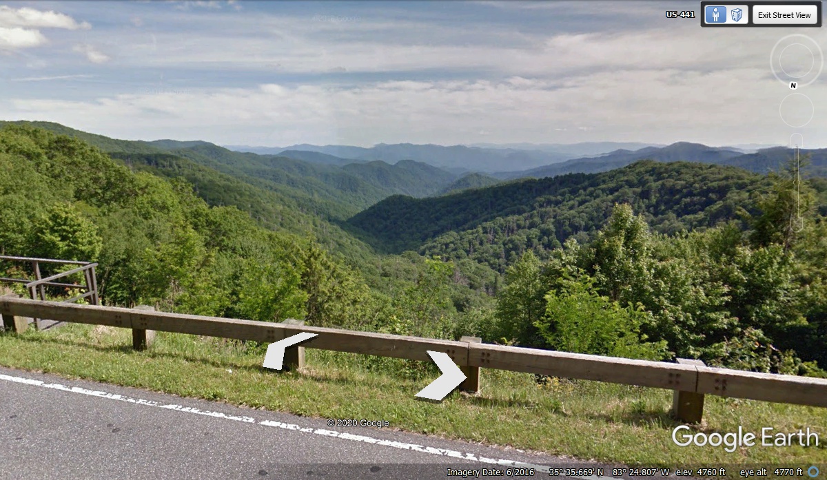
From deep in the woods to high on a mountain ridge, the ride through the
Smoky Mountains National Park on US 441 is worth every minute. This view looking
south is from an elevation of 4,760 feet above mean sea level.
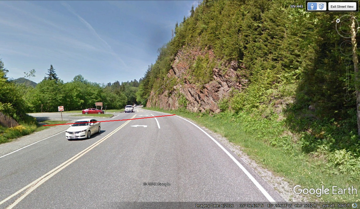
The RED LINE in this image is on the STATE LINE between North Carolina on
this side, and Tennessee on the far side of the RED LINE. This is the highest point for US 441 at 5,061 feet on my GPS reading at
the turnoff going to Clingman's Dome, which is 6,649 feet above sea level SEVEN
miles west of here by road.
We did not go there due to the 26 PSI low pressure in the right rear tire on
Linda's car on November 17, 2020. We arrived here at 9:10 AM. She wanted to get
down to civilization to get the tire pressure to all four tires up to normal
pressure values. We did not go to Clingman's dome this day. Since
this is a virtual tour, I will now drive to Clingman's Dome parking area and
give you some "snap shot" images from Google Earth along the way.
The US 441 views on the Tennessee side of the mountain continues on PAGE
12 which is the next web page. Finish reading PAGE 11 to get the
virtual tour of Clingman's Dome and the views from there.
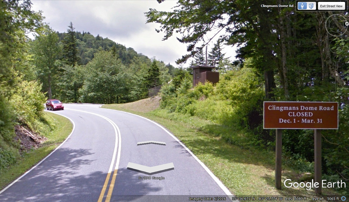
The gates to Clingman's Dome are locked from December 1 to March 31 every
year.
This visitor information sign gives the road closure dates. The "Out House" shack
is seen in more
detail in the image below this one.
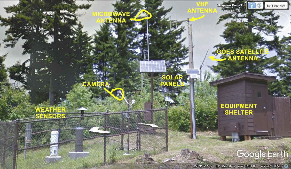
Since my career has been in communications, I thought I would examine most
of what I see in this photo below. Every thing here should be high enough
or inside the fence to keep bears from getting to the "stuff".
Except for the GOES Satellite Antenna, my guess is the other two antennas are
pointed to the park headquarters at the northern boundary on US 441. The
camera looks like a typical tilt, pan, and zoom camera seen along side
interstate highways or other locations monitored by the Department of
Transportation in many states. By now you probably discovered the
"Out House" is not a restroom, but an protective enclosure for
electronic equipment connected to all the things in this photo.
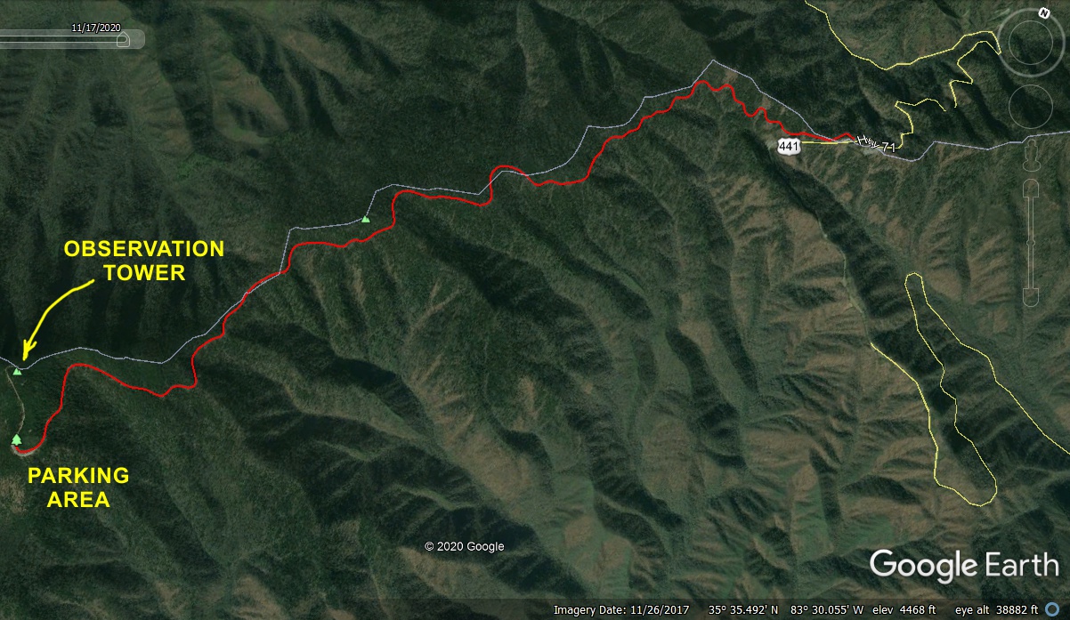
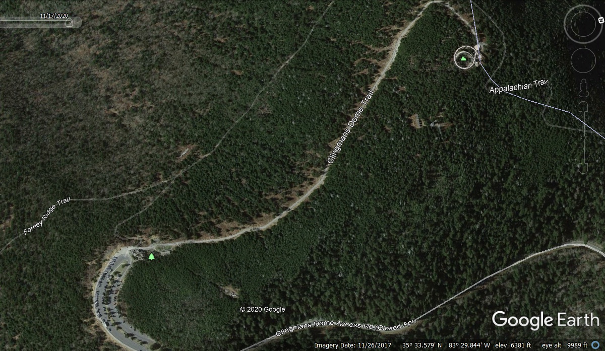
The RED LINE I have added to this image marks the access road to Clingman's Dome which is 7.0 miles
from US 441 to
the parking lot and the Visitors Center. Then there is the half-mile walk to the top of the mountain.
The other line with the two green triangles is part of the Appalachian Trail
that starts in the north Georgia mountains and goes all the way to the state of
Maine in New England.
This view looking down at Clingmans Dome shows the Appalachian Trail, the
paved Clingmans Dome Trail up to the observation tower, the Forney Ridge hiking
trail, the parking lot, and of course, the end of the access road to get here
from US 441,
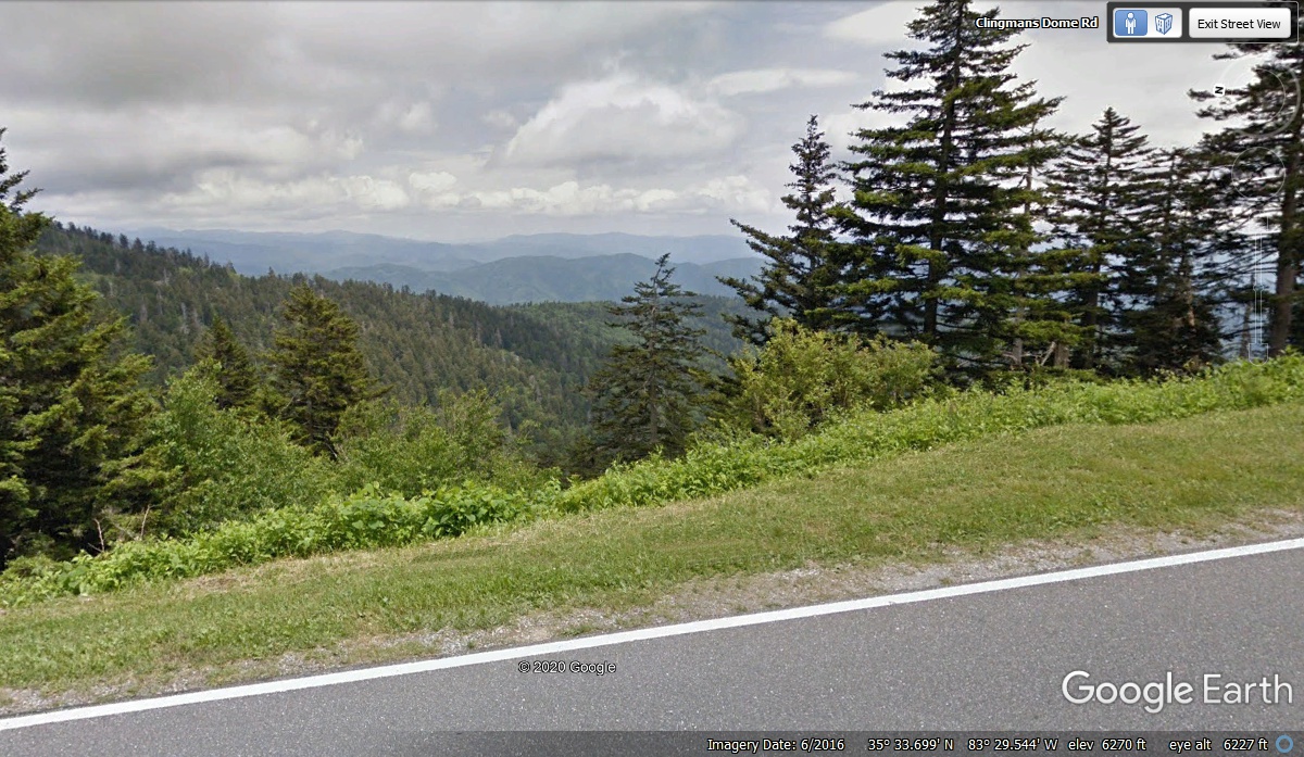
This is the last view from the access road before reaching the parking lot
at the Visitors Center. This view looks East.
Here is the first look at the entrance to the parking lot. The Jeep is
double-parked. The Park Ranger in this image drives the Toyota Prius.
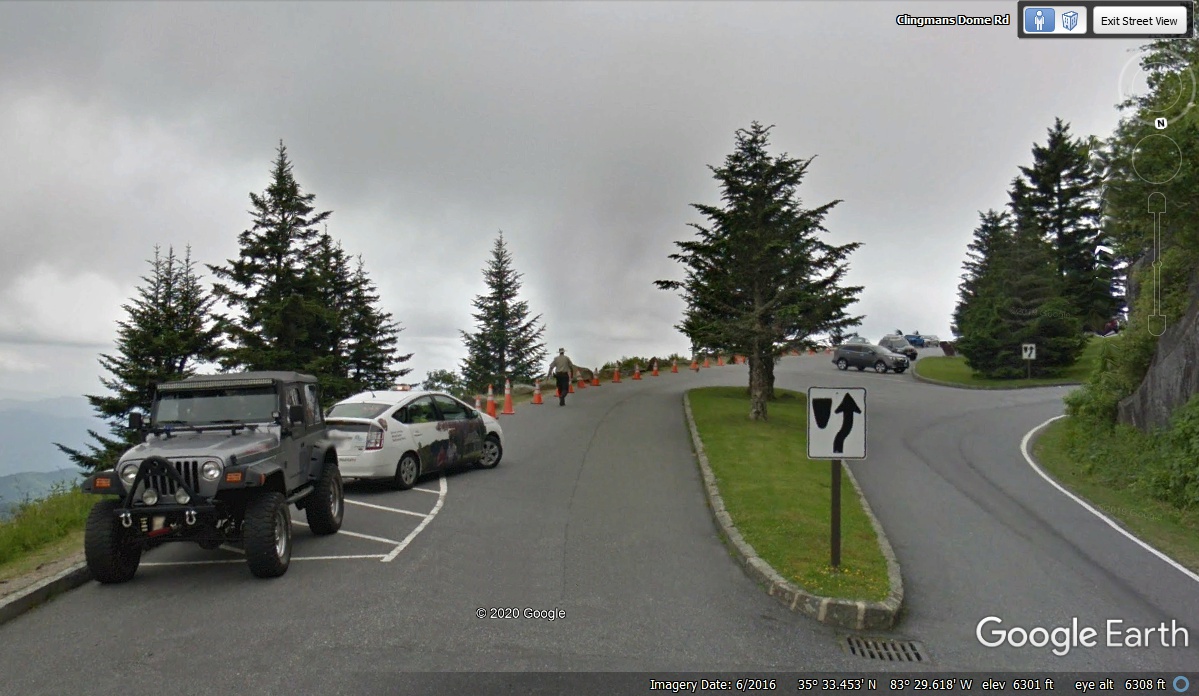
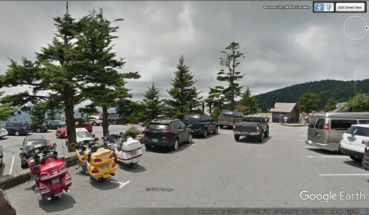
It looks like the parking lot is full on the day the Google Earth photo
vehicle was here in June of 2016.
The people riding the motor cycles parked well to only use two spaces.
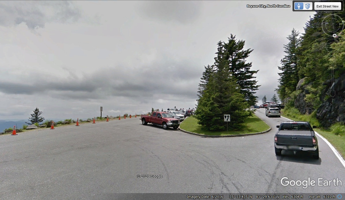
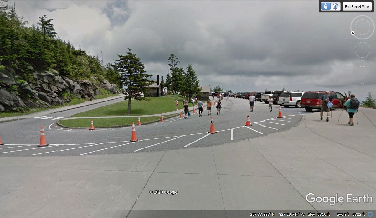
This image is looking south toward the parking lot as seen from the
walkway that goes up to the Visitor Center and the top of Clingmans Dome.
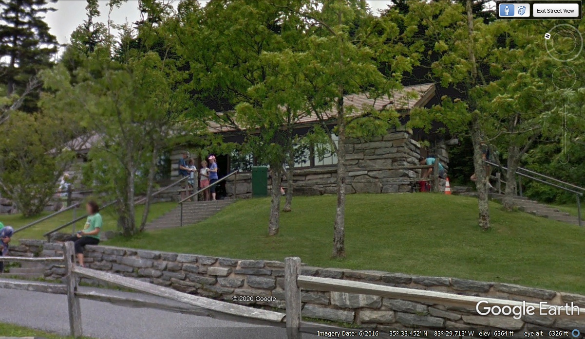
Just north of the parking lot is this visitor center. CLICK
HERE for details about the Clingmans Dome Visitor Center.
Unlike the highest point in Georgia, this trail up to the top of Clingmans
Dome is not a steep grade with a shuttle bus. This is a comfortable walk,
and it is wheel chair accessible.
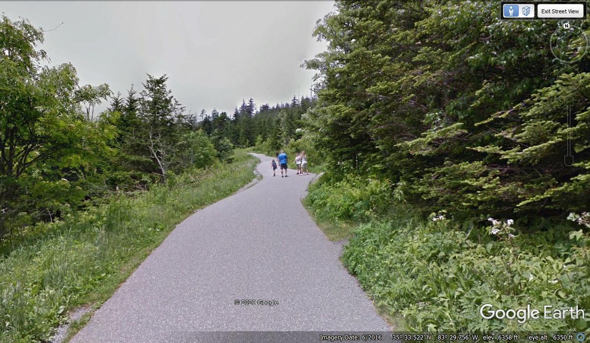
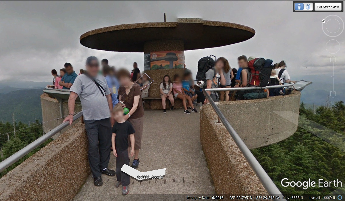
The mountain peak is a half-mile walk from the parking area.
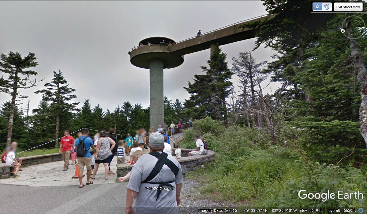
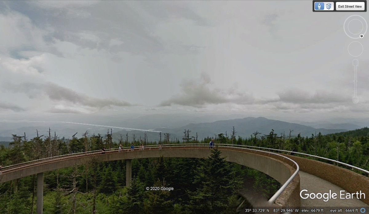
The viewing tower at the top of Clingman's Dome is wheel chair accessible
and has a lightning rod on the roof. Try to plan your visit on a bright
SUNNY day with HIGH PRESSURE weather for best visibility. The Google Earth
camera man wears a special back pack camera system that has the same
capabilities as the roof top camera system used on their vehicles. That is
how all these images from the parking lot to the top of the viewing tower were
acquired from Google Earth.
The white transparent straight lines in this image are put there by Google
Earth to indicate the North Carolina Tennessee State Line and hiking trails on
the ground. Those lines are best viewed when looking straight down to the
ground from about 900 feet above ground. If you look down from a higher
level above ground, the lines for hiking trails disappear.
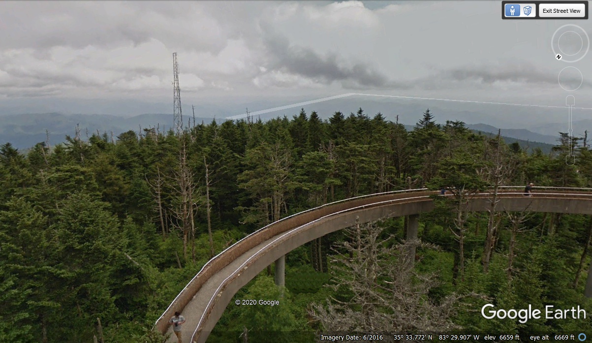
This view from the observation tower is looking southwest.